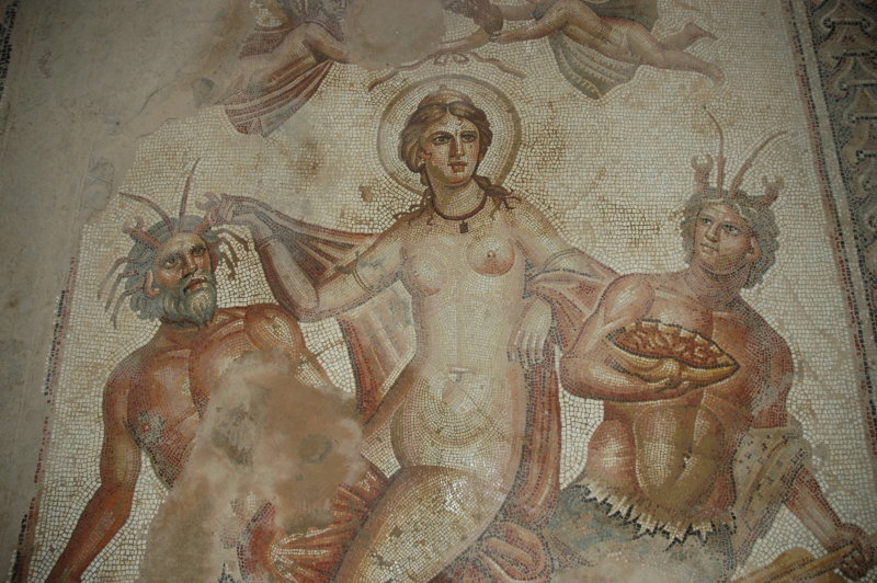
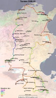
Tunisia, March 2008 (Part I)
Home |
Motorcycle Pages |
Forward to Part II |
Forward to Part III
We had been to Tunisia in 2007 and we did it again in 2008!
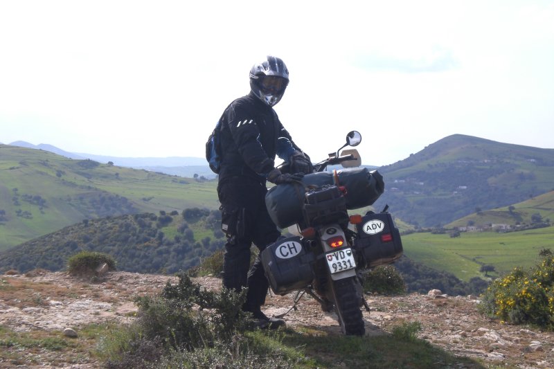
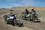
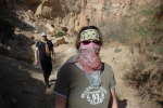
"We" means Petra on her Suzuki DRZ400, Florian on his BMW 650 XChallenge and Jörg on his 1990 BMW R80GS.
From March 7 to 29, we spent 20 days in the country, two days on the ferry and a bit for the "transit time" in Europe. Counting Tunisia only, we rode about 2800 km in this time and i guesstimate that about 3/4 of that
was on roads or tracks with no tarmac :-)
This trip has been published, albeit in a much shorter form, in the German magazine Motorrad 25/2009, pages 66...74.
Photos with names ending in -j are © by Jörg, those ending in -p by Petra and -f by Florian.
Top | Slideshow
Holidays!
As in 2007, Petra and Florian had started in Germany and arrived at my place near Lausanne on the evening before.
I had all my luggage prepared and packed, so we could start without much delay.
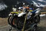
The challenge of packing three motorcycles onto a trailer that was originally designed for two bikes was resolved rather quickly:
We removed both footpegs of the DRZ, the left crashbar of the R80GS and a few small parts from the XChallenge.
Nevertheless, we were astonished how wide the exhaust system of a BMW XChallenge can be.
Leaving Lausanne at about lunchtime, we took the highway, passed the Grand St-Bernard tunnel towards Italy and headed down to the Aosta valley.
From there, we stayed on the highway for the next few hours. As in 2007, our plan was to leave car and trailer on a camping site somewhere
in the mountains north of Genoa. We arrived at our destination just around sunset and went down to the village for a Pizza in the excellent Trattoria.
Since it was already dark, the place owner asked if we would like to stay in a caravan instead of putting up the tents. We gladly accepted,
and this which turned out to be a wise decision: During the night it started to rain.
Top | Slideshow
It is not much fun starting your holidays in the rain, but since we had passed the night in the camping caravan at least the tents stayed dry that way.
We packed our luggage and reassembled the bikes. Then, taking mostly country roads, we headed towards Genoa. To cover the last few miles between the
outskirts of the city and the harbor, the highway is yet the most nerve-preserving technique to get to the ferry.
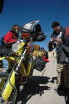
We boarded the ferry in the late afternoon. The Carthage is the flagship of CTN, the Compagnie
Tunisienne de Navigation. In service since 1999, it is a modern ship that offers place for about 2200 passengers and more than 600 cars. Upon
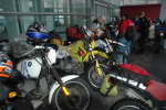
entering, the bikes are usually grouped together; this year, we were even handed brandnew belts to secure the bikes.
Since it is not possible to access the bike during the passage, you have to carry all that you need with you into the cabin. I had learned my
lesson from last year's transit, so I left all unnecessary luggage in the locked hardbags, the empty tank bag on the bike and took only the tail bag
with me, which contained all I needed for the next 24 hours.
Our cabin was on the inner part of deck 6, which meant "no windows", but since we intended to use the cabin only for sleeping this did
not matter anyway. Indeed the cabins are small but well equipped (air conditioning, shower, toilet). After lunch in one of the three restaurants
of the ship, we queued for the next part of the paperwork: motor vehicules are recorded in the passport, so you need to fill in several
forms and pass through three different counters, each with its own waiting queue. These counters were located near
the rear stairs of the ship on deck 6 and the procedure took quite a while - but it is quite a "cinema" to watch, too.
Having obtained all the stamps we needed for now, we went to bed. It was a calm night and a calm sea and there were still about 18 hours to go
until we would reach Africa.
Top | Slideshow
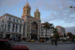
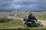
Tunis
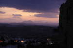
A good part of sunday was spent on the ferry. We arrived in Tunis early afternoon and could roll off the ferry soon.
Tunisian customs are usually very friendly (and much faster than their Italian counterparts), yet this year the GPS receivers had to be registered.
The related paperwork caused a small delay. - As usual, it is essential to have all the papers ready that you received the evening before.
I attached them to the top of my tank bag with a rubber strap, so I could present them quickly.
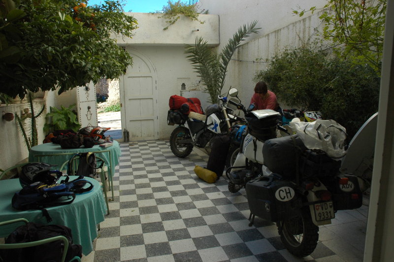
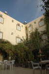
Leaving the harbour area, we headed straight for the center of Tunis. We had the adress of a small hotel directly in the center of the city, which we found on the first try.
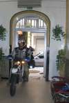
The reception of the Grand Hotel de France was very friendly and we could leave the bike in a secure room behind the reception -
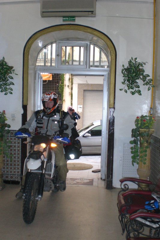
which means that we rolled across the entrance hall. Anyway, they seemed to be used to this, since a hotel employee immediately brought some metal weights that were used to hold
the doors in the open position until we were in.
The hotel itself is a place that we can recommend: big, bright, clean and very friendly. Great!
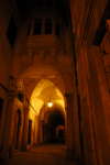
In the evening we enjoyed a stroll through the city. Most shops were closed, fortunately ;-). After a walk through parts of the Medina, we sat down at a
main road, enjoyed Tunisian pizza and just had a real nice evening.


Logistics
- Hotel: Grand Hotel de France, excellent!
- Total: 13 km ;-)
Top | Slideshow
Leaving Tunis
After a good breakfast at the hotel, we started the day with another little walk in Tunis - actually, we did some shopping
and changed money. Arriving back at hotel, we packed, checked out and finally left Tunis towards the west. We advanced quickly
on good roads through a surprisingly green landscape. This is not southern Germany,
this is northern Tunisia :-)

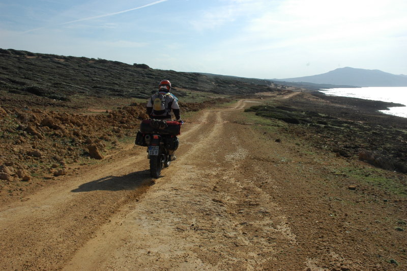
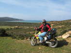
The coastal road
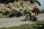
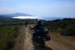
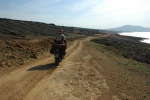
We continued the trip and reached the coastal road near Cap Serrat as planned.
This was actually the first dirt road of our trip; it runs for many kilometers along the north coast of Tunisia
towards the west. Most parts are very easy to ride, but we also managed to run into a strech with fine sand.

Tabarka
We continued towards Tabarka, followed our guide book and checked into Hotel Novelty. It seems that we were the first guests of the season,
since the heating was not switched on yet (it would stay off for the whole night anyway) and it even took quite a while until we had hot water for a shower
(an experience that was confirmed near the end of our trip: If the receptionist asks you to pay the room in advance or before the night,
make sure you have received all services you need beforehand. This this concerns in particular hot water ... and sanitary installations!).
Anyway, the hotel as such is a nice place, the waiter in the restaurant had a good sense of humour,
and we had a locked garage for the motorcycles just a few meters down the road.
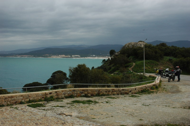
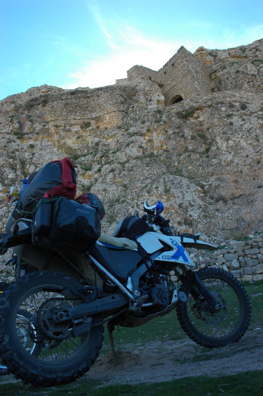
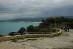
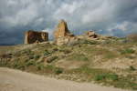
Tabarka itself is a growing city; the town is dominated by an offshore rock with a Genoese castle
(view on Google maps).
The city shall eventually become a huge holiday ressort; we took a stroll down to the harbor area
and saw a lot of hotel buildings that were under construction. Indeed the location is certainly great for this;
it lies on a wide, protected bay with the fort on a peninsula. The causeway to the island also serves as one
side of the marina where you can find fishing boats, visiting yachts and "pirate ships" for tourist excursions.

Logistics
- Hotel Novelty, Tabarka.
- Total: 212 km.
Top | Slideshow
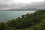
Leaving Tabarka
We woke up to a gray, cloudy sky. After checking out of the hotel we rode down to the harbor area again since I wanted to take
some pictures, in particular of Les Aiguilles - jagged rock jumping out of the Mediterranean sea in a small group.
However, the wind was getting strong, rainclouds gathered, so we decided not to explore the region but left towards the
south.
It started to rain shortly afterwards. We crossed the mountains via the city of Ain Draham in the rain ... which was
not entirely adrenaline-free for Petra and Florian with their Michelin Desert tires.
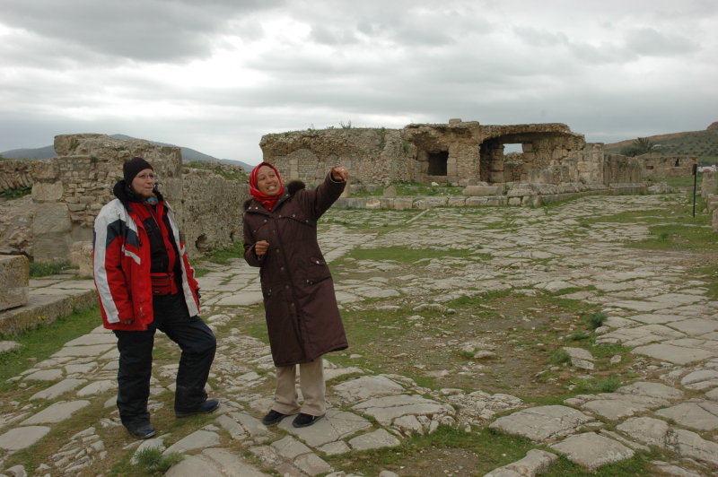
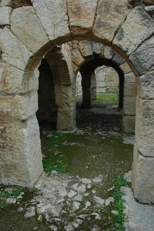
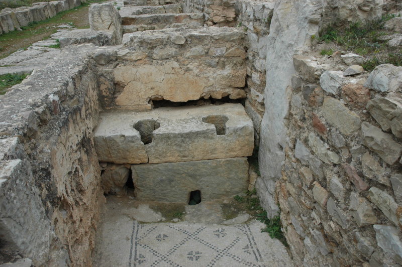
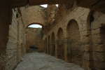
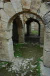
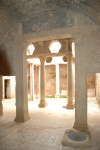
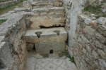
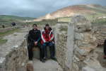
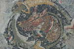
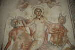
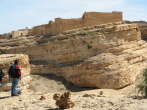
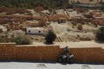
Bulla Regia
Upon our arrival in Bulla Regia (Google maps,
Wikipedia entry), the rain stopped. While Florian decided to stay with the bikes,
Petra and myself went for a visit of the site. A local lady offered her services as guide,
and indeed she turned out to be very knowledgable and kind. Her fee of 15 TD was well invested!
After almost 2 hours of culture, we were hungry. The "official" site only sells drinks on the site,
but does not have a restaurant ... After a search along the road we found a stand where asked for a little menu,
were served a lot of stuff and were ripped off at 28 TD. But hey, these are holidays and the food was delicious :-)

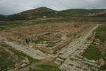

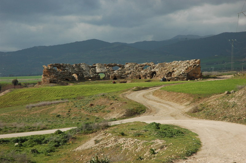
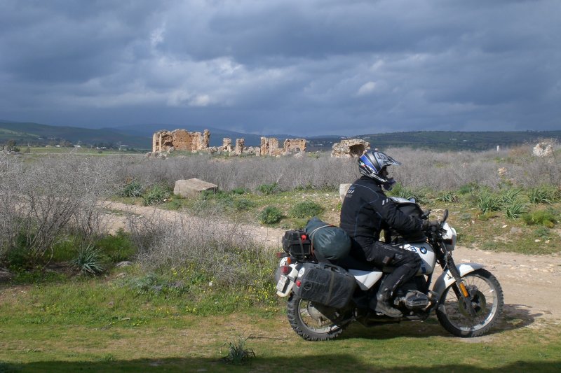
Chemtou
We then continued to the southwest and after a few kilometers we reached Chemtou (also called Chimtou;
Google maps,
Wikipedia entry).
Chemtou is yet another antique (roman) site in the region and is known for its important yellow marble quarries
which were exploited from the 2nd century BC. Since we already had a huge dose of "culture" just an hour earlier,
we did not perform a guided tour here but just rode around and enjoyed the site. But there's a lot to see!

Le Kef
The reminder of the day brought us to Le Kef (lexicorient.com),
where we found the Hotel Venus in the uppermost part of the city - not easy to find, but a very
nice place to stay. The shower and the hot water were operational :-)
A stroll through the city revealed that the name of the hotel was not accidental; in Roman times there was a temple nearby,
and they even employed temple whores (!).

Logistics
- Le Kef, Hotel Venus.
- Total: 150 km.
Top | Slideshow
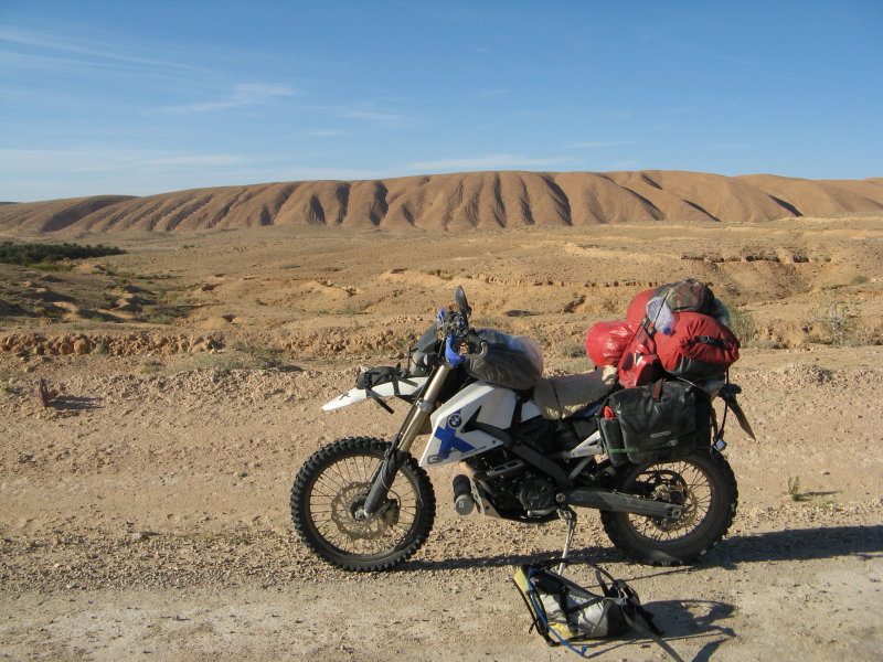
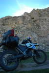
Getting ready
On my motorcycle I had changed the steering head bearing a few months earlier and during the past day I had noticed a few "clonking" noises when the fork hit potholes.
Indeed the bearing had become loose, so the first thing after breakfast was to take the gas tank off and to fix this.
We then packed our luggage, left the Hotel and headed for the next shop. We planned to stay two days in the wilderness,
more or less far from any major city, so we packed some food plus a huge reserve of water.
Fortunately, the weather was sunny but cool, so riding was a pleasure.
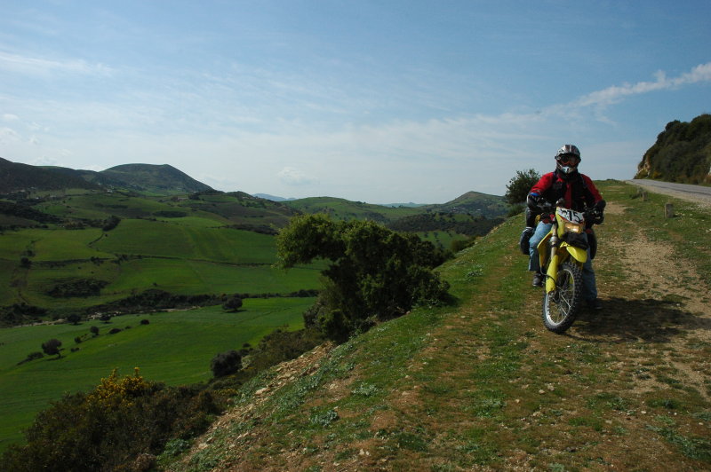
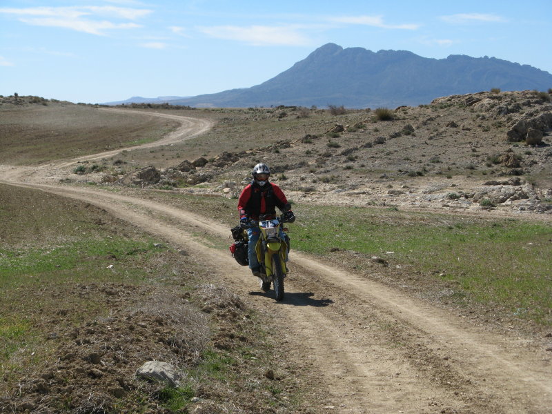
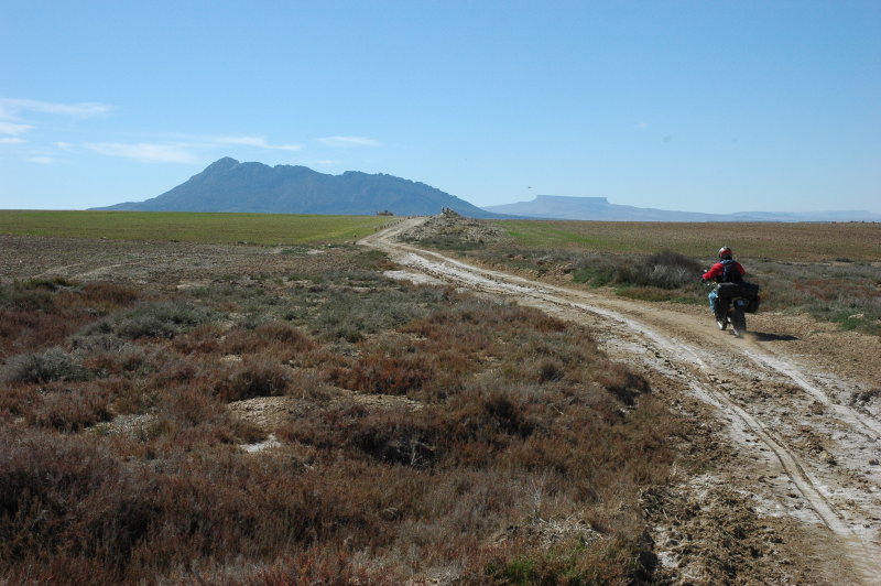
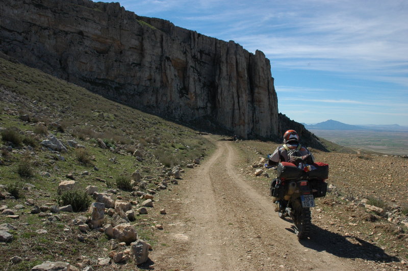
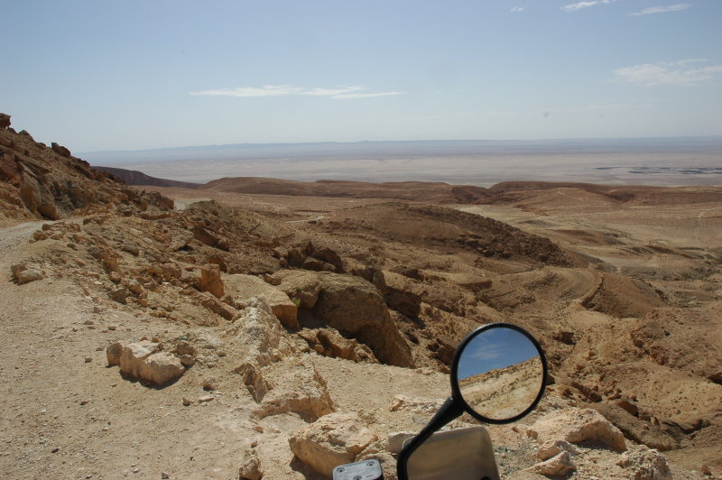
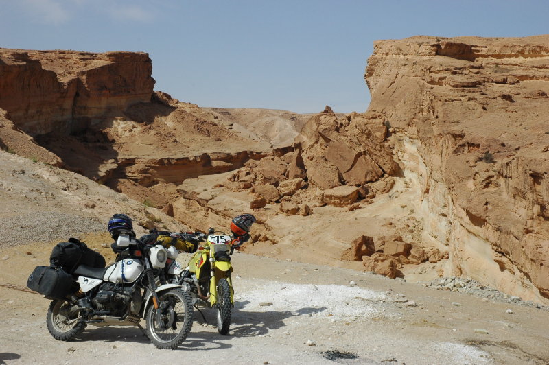
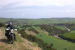
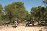
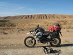
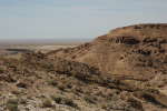
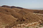
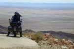
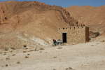
The ride towards the Table de Jughurta leads through a varying, but deserted landscape.
I was glad that we had detailed tracks (that I had converted into an overlay map for the GPSr), so we were condident to follow all those trails that only seemed to lead to the
nearest farm ... but that were indeed connecting roads.
On one of these roads, Petras DRZ decided to throw off her rider. Nothing damaged, no harm done, but a good moment to take a break.
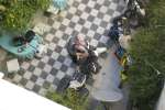


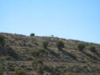
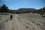
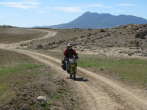
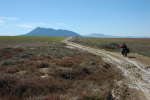

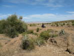
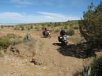
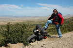
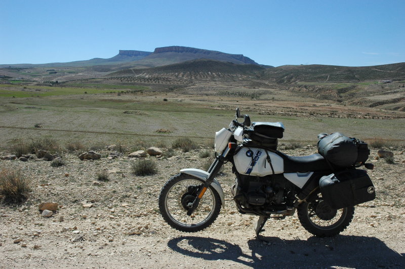
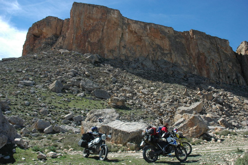
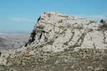
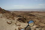
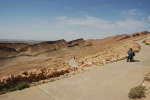
Table de Jughurta
The Table de Jugurtha (Kalaat es Senan; www.jugurtha.com,
Google maps)
is a unique high plateau, a flat-top mountain that has the form of a truncated cone flanked by rock walls
rising vertically to a height of 70 m. Due to its isolated position and the very good control of the surroundings, it was formerly also (mis)used
as a "castle" by outlaws. From here there are magnificent wide-ranging views.


A place for the night
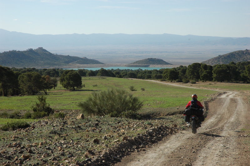
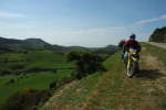
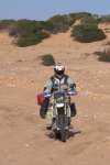
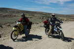
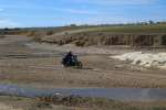
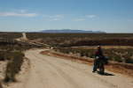
We continued south, on secondary roads that led through a great landscape. Much of the time was spent standing in the footpegs, since there are lots
of potholes or other, well, "surprises" on the road. After all, I had the oldest bike, the worst suspension, the smallest ground clearance ... but
I was also the one that had the overlay map on the GPSr, so I was "encouraged" to ride in the first position. The big advantage is that you don't swallow dust :-)
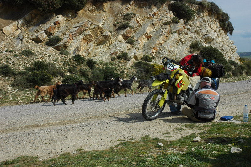
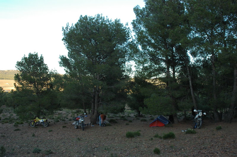
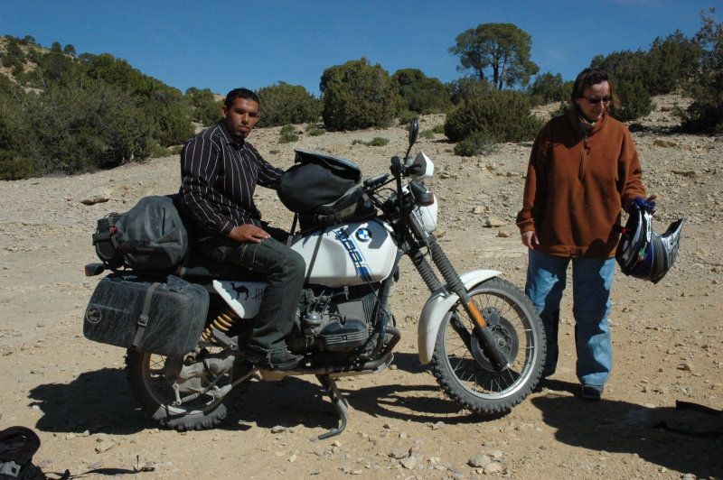
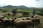
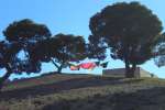
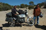
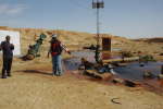
As planned, we looked for a place where we would spend the night. We knew that there was no Hotel around, so - after helping a man fixing a flat on
his truck - we chose a small forest hill near the J. Azered, picked a place that was sufficiently far from the next road and put up our tents. A few shepards
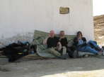
passed by, we heard a few wild dogs howl and bark in the distance, but that was all. The night was calm and Florians special rhum helped with the sleep.

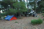
Logistics
- Camping in the forest.
- Total: 139 km.
Top | Slideshow
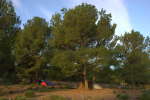
Coffee, anyone?
The night was calm and mild and I woke up right before sunrise. We decided that we would have breakfast and coffee in the next village, so we packed
our camping gear and headed south.
The only problem was that there was not exactly a village for quite a while, at least not one that had a visible café ...
so we continued without coffee.
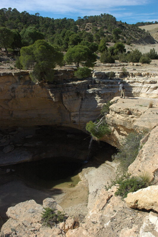
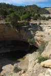
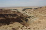
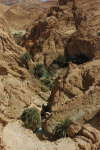
We took a break at a beautiful, scenic canyon about 5 km NW of Bouderies (
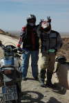
view on Google maps). The canyon is accompanied by an artificial lake and as usual there is a guardian, too. He first observed us from the distance,
but then joined us - after all, a day in that place must be quite lonesome. He did not speak a lot of French, but it was enough for a
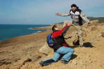
few photos with the motorcycles :-)
Meet the National Guard
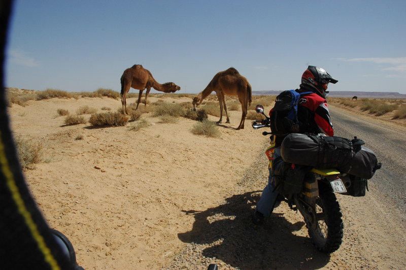
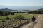
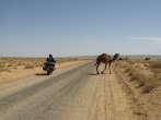
After a while we hit some strange matter that we had not seen in a while ... tarmac! We advanced at a good pace twords the south.
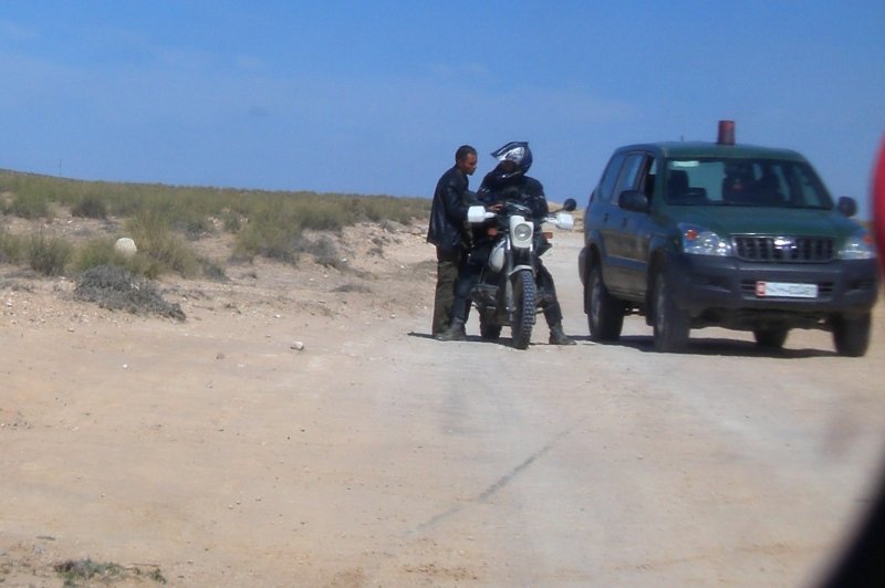
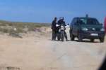
It was then that we noticed that a car of the National Guard was following us.
We had noticed this car earlier, near Foussana, at a traffic control
in the opposite direction. Apparently following a few foreign motorcyclists could be more interesting than stopping Tunisian motorists ;-)
For a while that car stayed simply behind us, but in one village he drew line with me (since I was the leading bike of the three) and
requested that we stop. The two men checked the passports, we had the usual, friendly chitchat but the boss would not want to let us go yet -
he was verrrry busy on the phone. After a while he finished his call, explained that we should really, really not turn
towards the west (Algeria!) and wished us "bonne route". All fine, so we headed off.
I should perhaps mention that a couple of Austrian tourists had disappeared near the border to Algeria about two weeks ago,
and was still missing at the time of our visit. Since tourism is one of Tunisias major ressources, it was obvious that they
would not want anyone else to disappear!
After another while, we noticed that the same car was still following us.
At the next crossing, the GPS track that we followed supposed to turn westwards, follow the road for a short while and the turn south again.
Of course we heard the car horn behind us, the leader of the two waved us down to a stop immediately and it took me a while
plus lots of words and gestures to explain him that we knew exactly where we were going and that I would guide us south again
after a few hundred meters. Finally he agreed and we were off again.
The same procedure repeated itself a few times - every time we came to a too-long stop, or whenever we needed to roll back a
few hundred meters because I missed a waypoint, he came over to me and asked "show me where we are". On the Michelin map,
scale 1:800k, this meant pointing the finger in the big white spot north of Sidi Bou Baker and saying "somewhere here".
Moving over to the GPSr, I always refined my answer to something like "about 30 km north-northwest of Sidi Bou Baker". With this information,
he took the mobile phone and was busy again for 5 minutes - always behind the car, out of earshot for us but also for his colleague.
The first one or two times I believed that he was verifying if we really knew where we were ... but then it deemed to us that
it was pretty much the other way round: as far as I could tell they had no GPS and no reasonable maps in their car, so we have
reasons to believe that he was telephoning to give their position. Indeed they let us go in the next village where we met
tarmac again (a few km north of Sidi Bou Baker) - and after more than 100 km to go back, you bet that they had something to tell
that evening!
This was the day when we encountered most controls (iirc some 5 or 6 control posts). Indeed we were handed over from the
National Guard to the control post at Sidi Bou Baker and even as we stopped there a military car came to us and asked if all
was well. However, I do believe that the appearance of a military jet passing right over our heads at that same moment was
purely accidental ;-)
I want to point out clearly that all military and police controls that we ran into were absolutely friendly, correct and polite.
Even if they do not want you to go into a certain area - this happened once, very near the Algerian border - they tell you
in a very friendly way that "this is not good for you". They always controlled our passports and were always glad to discuss
a bit with tourists, too. We never encountered any trace of corruption or other trouble.


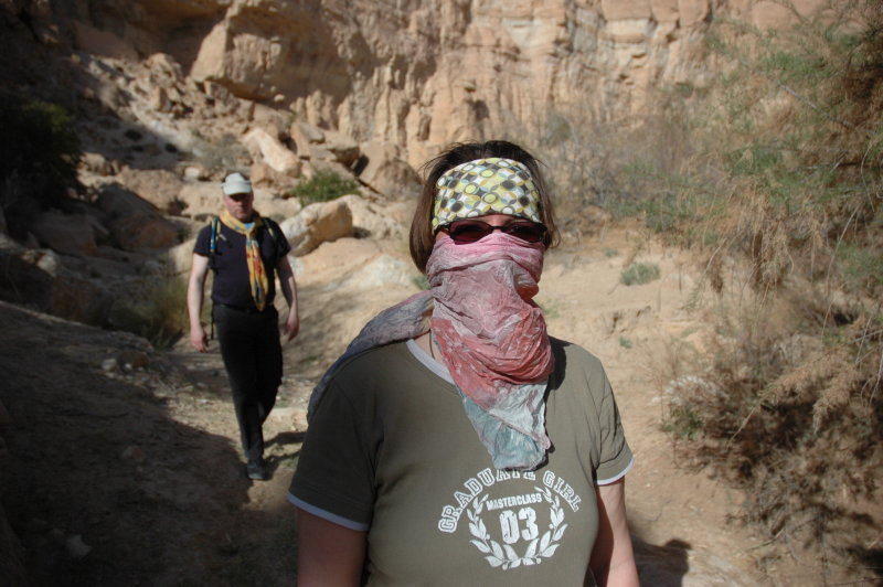
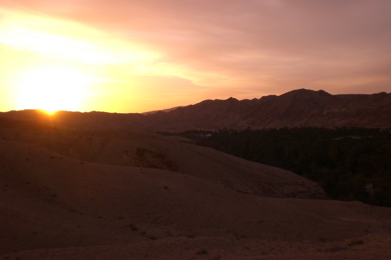
Towards Tamerza
The reminder of the day is told quickly: It was a hot day, we had spent two days in the wilderness and the whole day of today in the desert,
so we headed rather quickly towards Tamerza, where we found a nice place to stay at the camping "Les Cascades".
Logistics
- Please note that there was no gas station since Le Kef; the next official gas pump near Sidi Bou Baker is only in Moulares.
- Camping "Les Cascades" in Tamerza.
- Total: 218 km.
Top | Slideshow
Getting ready
This day was made for visits and relaxation.
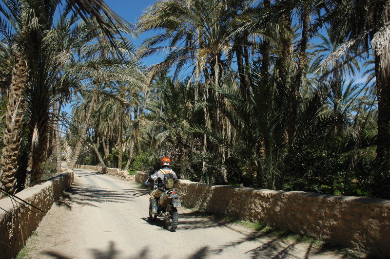
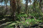
We started the day with a round-trip around the neighbouring oases. Leaving towards the west, we headed through the
spectacular mountains west of Tamerza, then towards the south until the oasis
of Chebika (view on Google maps).
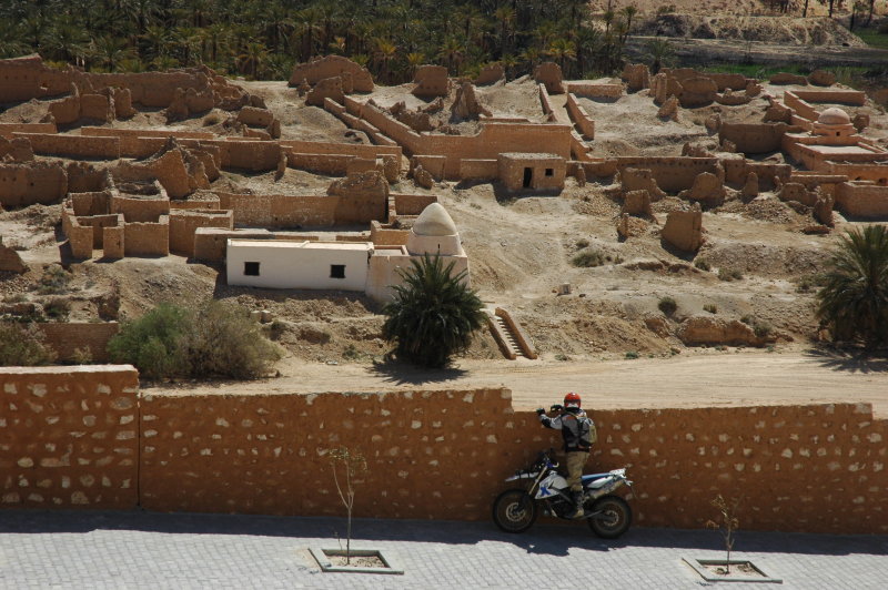
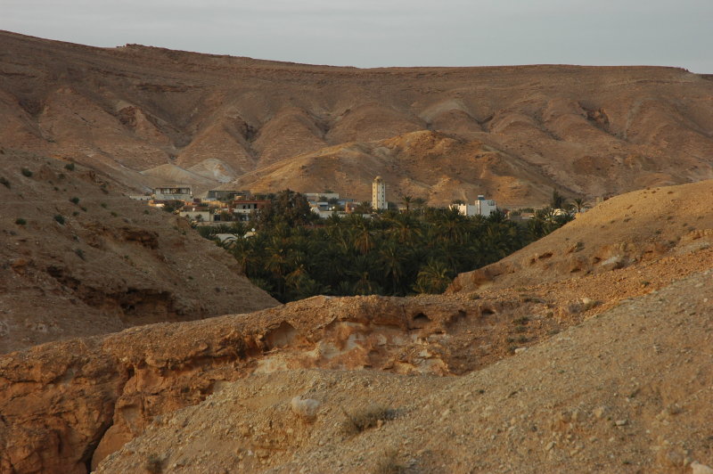
Chebika
From lexicorient.com:
Chebika belongs to the collection of unlikely desert oases of the mountains north of the great Tunisian chotts. Least famous,
Chebika offers perhaps the most effective and dramatic experience among them. Chebika is best experienced before you head on to
Mides and Tamerza, after crossing the Chott el Gharsa, which most of the year just looks like wide barren field.
Where the mountains rise, Chebika lies. Most of the year it is so exposed to the sun that it once was known as Qasr el-Shams,
Castle of the Sun. - The whole tourist thing at Chebika is laid out as if it was planned by experts. And with the high number of
tourists visiting Chebika, it could be taken for being artificial. But it is not, the layout serves agricultural needs only.


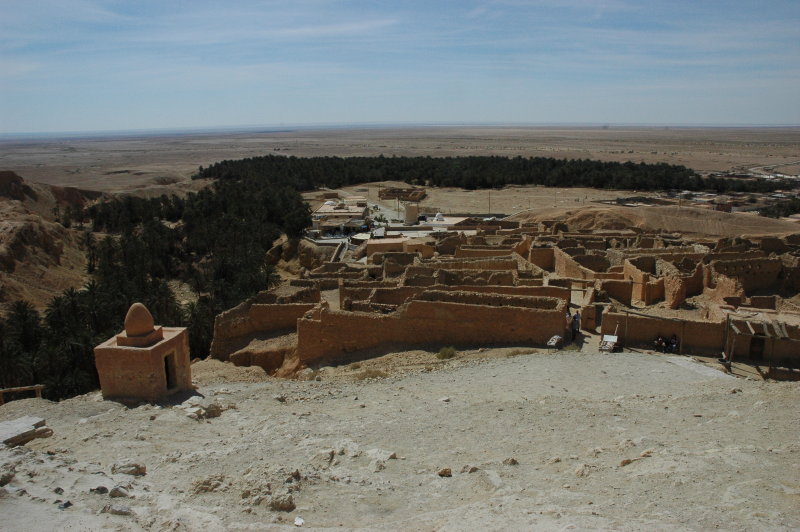
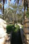
Mides
The next step of our visit lead us back to the north, towards Mides (
view on Google maps).
From lexicorient.com:
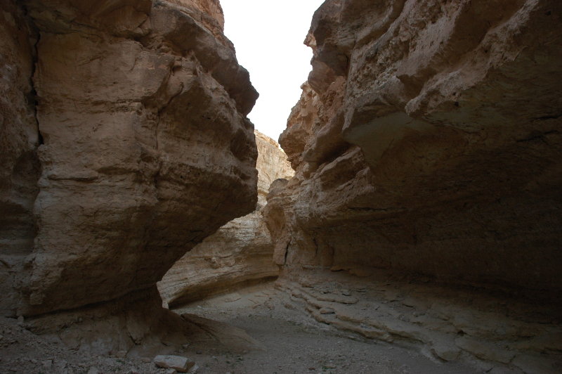
Mides may be the most attractive of Tunisia's mountain oases, with a stunning gorge stretching for 3 km. The gorge was used as part of the village's
natural defence in older days. The gorge is distinct with its round shapes and strong contrasts in colour. The modern village is no more than number of
white houses scattered around the barren hill above the oasis. It is like the locals didn't know how to arrange themselves when external threats were gone
in modern times. The traditional village was abandoned in 1969 when a flood after 22 days of rain destroyed many of the houses.


Tamerza
On the road between Tamerza and Mides there is decent-sized lake. We rode towards it and the ride revealed that the area is filled with lots of junk
that is apparently either dropped here, or carried here by the floods. It is a strange experience to ride across a surface when you hear PET bottles
crunch at every rotation of the wheel ... !
We then rode back to Tamerza.
From lexicorient.com:
Tamerza is the largest mountain oasis of Tunisia. The mountain oases lie in the mountains north of the salt lakes and receives water from springs in the barren mountain.
Spectacular effects between dead and living nature makes the area a gem for visitors.
Tamerza has two waterfalls, gorges an oasis and an old town, now abandoned. (...)


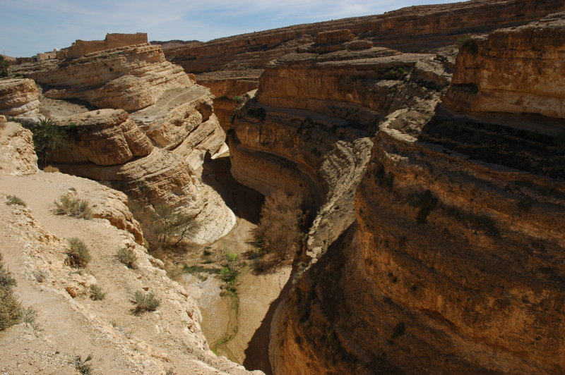
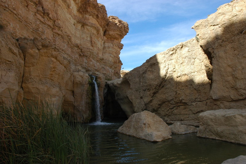
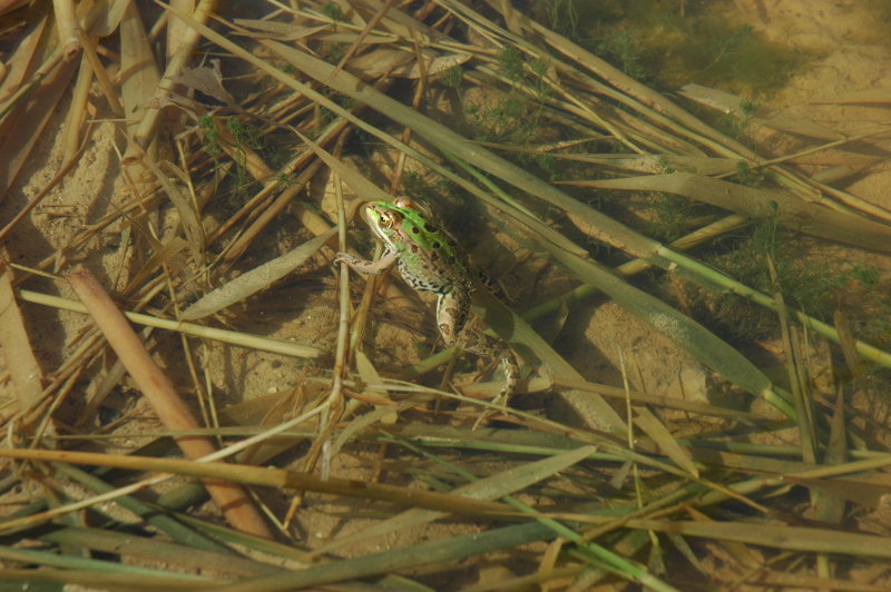
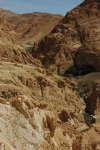
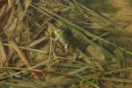
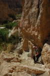
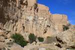
Walk through the canyon
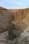
Another waterfall of Tamerza stands a few kilometres west out of the town and we explored its canyon a bit.
Many tourist stands and cafes have been put up around, but just a few steps below you meet a small green zone,
with a nice variety of life. There are even frogs here, making up their colony.
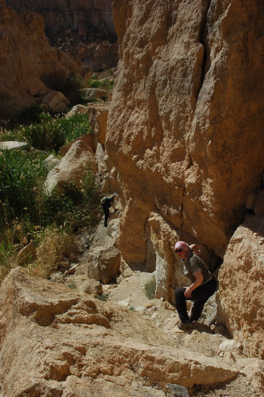
Walking the canyon is quite impressive, since it involves a lot of moving around, climbing and descending.
It was too hot to make it to the end, but the vegetation, the landscape and the surrealistic site make it
well worth the visit.


Back into the Oasis and .. the next walk!
We arrived back into the oasis and while Florian was relaxing, Petra any myself went to explore the next place.
The main waterfall of Tamerza is about 5 metres high and it situated directly below the camping site (view on Google maps). The stream running from the waterfall leads to the
Gorge of Tamerza, where reportedly a few scenes from The English Patient were filmed.


Logistics
- Total: 53 km on the bikes. I did not measure the distance we spent walking ;-)
Top | Slideshow
Rommelpiste
We had breakfast at the camping, then packed and left Tamerza in search of the "Rommelpiste". This is a track that was
created by Field Marshall Erwin Rommel during WWII and it is a spectacular ride. The concrete track starts in Redeyef and
leads across the mountains, down to the Chott El Jerid.
Further South
The road towards Tozeur is quite an adventure to ride: It is a wide, straight line of tarmac where huge trucks run at high speed.
While this is nothing special, there are frequent roadworks that cause deviations and we even found ourselves running in a thick
layer of loose, fine gravel for several kilometers - of course with trucks around ...
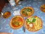
Before arriving in Tozeur, we stopped at a café in An Namlat. Asking for a sandwich ("casse croute") I learned that a
Tunisian café offers only drinks, nothing to eat ... but no problem: The young patron just left his business behind
and walked with me into a side road. We stopped at a small, blue window in a bright white building with arab lettering around and he
shouted a few words inside. After a short while, an old face showed up inside and after a few translations we went back to the
café - loaded with three delicious sandwiches!

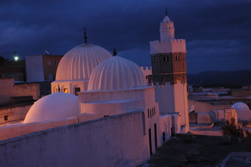
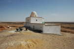
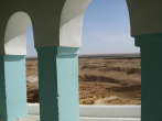
Marabouts
Sitting at the café and flipping through the pages of the travel guide book, Petra mentioned a few Marabouts that were nearby.
A marabout is, in the first place, a holy man and by extension his place of burial. These tombs are easily recognized since
they commonly have round, white domes. Almost every village has at least one of them.
Since we were not in a hurry, we decided to visit them right now.
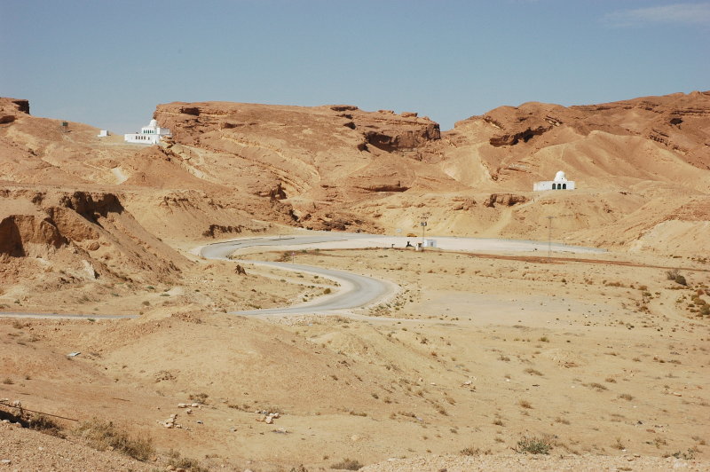
Arriving at the marabout of Sidi Bou Hellal (and another one nearby; unfortunately I have forgotten the name;
view on Google maps),
we rode up the hill and took a rest in the shadow of the wall. Since this is a sacred place for muslims, we were
not sure if we could enter, but the spectacular view, the gorges (reportedly, yet another Star Wars site)
and the silence up there were already perfect reasons to be in that place.
After a short time, the door opened, a man looked out, then the door slammed. Oups?
After another short time, the door opened, the man came over to us, greeted and gave us a carpet to sit on.
Then he left again and the door slammed again. That was when I noticed that the slamming was simply caused
by the wind ... !
After yet another time, the door opened again and we were handed a delicious mint tea - !
We had a nice talk with the man and learned that he is the grand-grand-grand-(add some more)-grandson of the holy man that is actually buried
here. Indeed this "job" is handed over from one generation to the next and his son is already prepared to take over
one day.
We received a guided visit of the place. Essentially, there is a small inner court, surrounded by a few chambers
where you can cook and sleep. The only room that is inaccessible for us Christians is the sanctuary itself, but here
our precious guide simply explained that while we were not allowed to enter the room personally, nothing would stop our
cameras to go there: So he simply took the photo for us!
For me, this was yet another one of those great moments when you feel that albeit you do not necessarily share the
same language nor the same culture or religion, you simply understand each other since you share the same respect,
and perhaps the same sense of beauty. I just love those moments.


Arrival in Tozeur
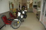
Arriving in Tozeur, we quickly found the Hotel Warda. It looks quite modest from the street, but looking at the inside I wondered
how Tunisian hotel "stars" are assigned: This is "only" a one-star hotel, but a very nice place to stay. At a price of 42 TD for
all three of us including breakfast we really could not complain :-)
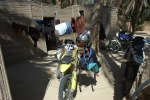
The bikes were parked in a side entry of the hotel, directly in front of the manager's room. Fortunately we did not have more than
three bikes, since the space was quite, uhmmm, confined. However, the receptionist told us that the hotel indeed had rented a garage
recently, but at the time we were there the key had disappeared ;-)
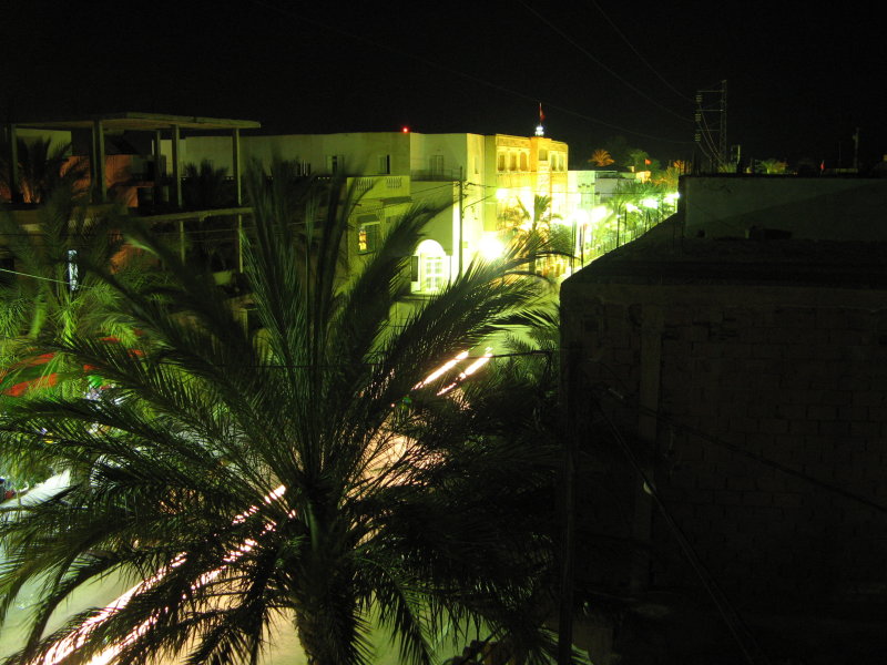
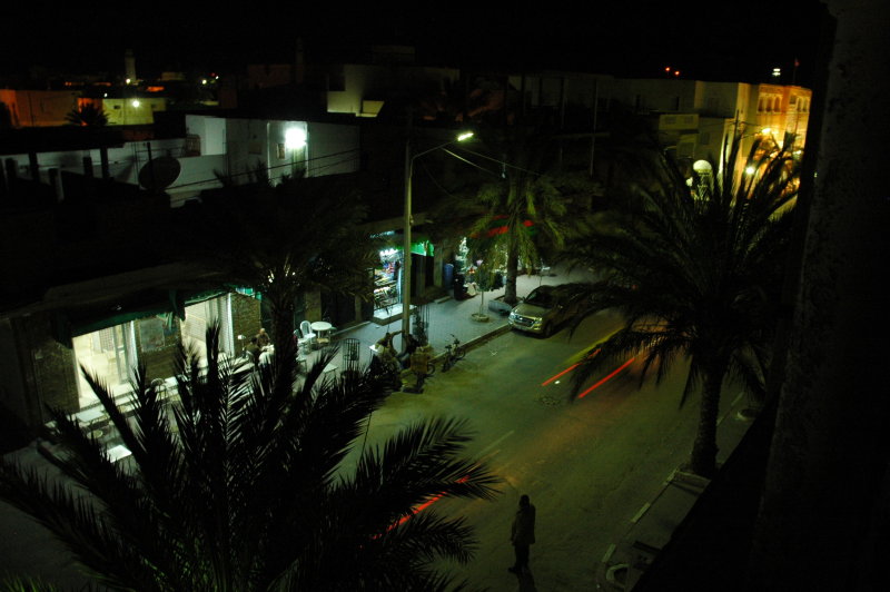
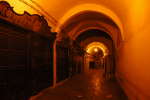
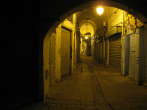
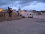
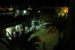
Tozeur at Night
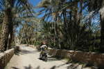
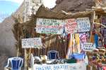
Tozeur is an impressive old town that was once, like the mountain oases, a Roman outpost and a stopping point for the caravans coming from the
Sahara. A beautiful city with lots of palms that today lives pretty much from tourism, but everything is done in a tasteful manner. The old center
of the city probably remained almost unchanged over the centuries; the house and decoration style is ancient and dates back beyond the 14th century.
In addition, there are lots of interesting doors to spot - but we have been here just last year, so we did not really feel the urge to repeat that
right now. In addition, even the Tunisians said that this day was too hot for the season, so we preferred not to move much more than necessary.
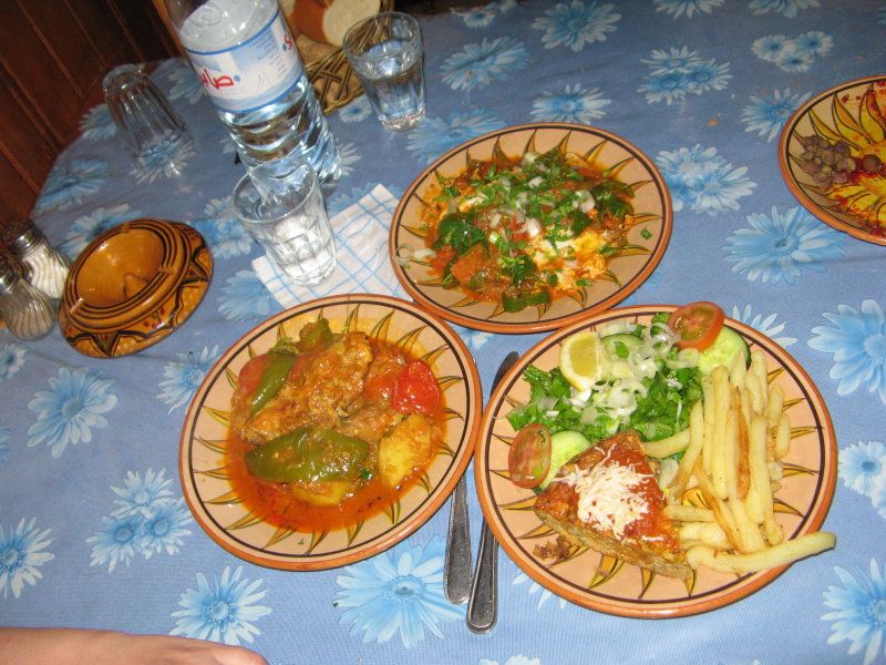
Even the restaurant was right on the other side of the street :-)


Logistics
- Hotel Warda, Tozeur.
- Dinner: Restaurant "Le Soleil", Tozeur. Good food!
- Total: 127 km.
Forward to Part II, Part III