AdvRider European Meeting 2006

You can also watch these images as a slideshow.

The story

Advrider.com strikes again

It all started on the AdvRider.com website.

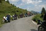
In 2005, an intrepid Italian enduro rider named GiorgioXT organised the first European AdvRider meeting, which took place around Bardoneccia, on the same date and almost the same place as the "Stella Alpina". In spite of the rainy weather and an overdose of Polenta ;-), the meeting was such a success that it became a sheer necessity to organise another event in the following year.

It was GiorgioXT again who took care of the organisation of the event in 2006. It was scheduled for mid-july again, this time lasting for about one week and taking place in a region that Giorgio knows very well, since he lives there: The Dolomites!

Having met this bunch of crazy people already in 2005, it was obvious to me that I just had to participate again ;-) I scheduled the trip so that I could visit a colleague and friend in Italy that I met years ago and that I wanted to visit for quite a while at her home near Padova.
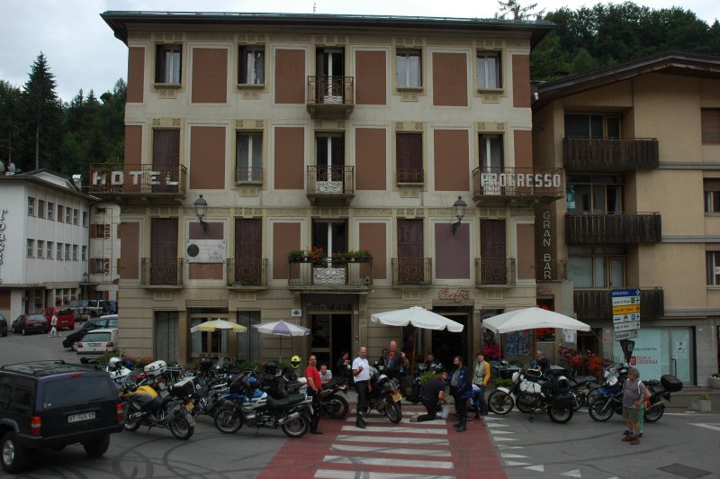
Sunday, 2006-07-09

Get going!

We had been dancing on the evening before and it was not before two o'clock in the morning that we were in bed. I woke up to a slightly cloudy day and finally I managed to start this trip. After having packed everything that I thought I might need on the bike, I took the rather direct way from the Lausanne region to the east, passing via Gruyères and over the col de Jaun (1509 m), then another rather unknown, small 1700 m pass near Seeberg (which is more frequently taken by bicycle riders than motor traffic). The still-clouded sky made it a bit easier to speed up and to ignore the beautiful locations to the left and right side to the road, so I merely passed through the Interlaken region on the far-less-romantic road south of lake Thun and soon after I was at the Sustenpass (2259 m), which offered a spectacular view to its famous glacier and lake from just beneath the clouds.

./20060709T114315.jpg ./20060709T123051.jpg ./20060709T123204.jpg ./20060709T123939.jpg ./20060709T142848.jpg ./20060709T143512.jpg

Advancing through a beautiful landscape

The route led me via Andermatt and the Schöllenenschlucht to the Oberalppass (2044 m), where the clouds withdrew and left a bright blue sky. Once again in a few hours, the local language changed; after French in the morning and and German at lunchtime we were now at the 4th national language of Switzerland, the Rätoromantsch. It sounds like a charming mixture of Italian, German and French, combining the more beautiful phonetics of all three.

Passing through Obersaxen and following minor roads towards Bonaduz, side valleys like the Versamer Tobel offered quite some spectacular views. It was a surprise to ride along soft alpine meadows and a few turns later to be catapulted into a landscape that resembled the French Alps ;-)

./20060709T150512.jpg ./20060709T151232.jpg ./20060709T152318.jpg ./20060709T162734.jpg ./20060709T164624.jpg ./20060709T164859.jpg

Hotel Piz Ela

The day was hot and I was getting tired. The final kilometers of that day led me via Thusis and Tiefencastel to Bergün, where I had reserved a hotel room in the Piz Ela. Both the hotel and the village turned out to be a very nice place: The hotel was an old postal station situated right in the center of an old village and the beautiful Biergarten in the backyard was just prepared for the live transmission of the final match of the football world cup. The food was delicious and needless to say, the party was great when the Italian team won :-)

./20060709T170326.jpg ./20060709T173341.jpg ./20060709T190731.jpg ./20060709T184450.jpg ./20060709T201609.jpg ./20060709T203843.jpg

Bergün, some pictures of the village

./20060709T184635.jpg ./20060709T184954.jpg ./20060709T185209.jpg ./20060709T185412.jpg ./20060709T185657.jpg ./20060709T185823.jpg ./20060709T190138.jpg ./20060709T190424.jpg ./20060709T190511.jpg

Monday, 2006-07-10

Alpine passes for breakfast

Having slept very well at 1300 m, I had a good breakfast and started the day towards the Albula pass (2312 m). A spectacular "add-on" to the pass ride is the view onto the Albula-Bahn, a train that crosses the pass in a number of climbs and bends that are often carried by viaducts. Accompany this with almost no traffic, perfect temperatures, a splendid scenery and a crisp blue sky ... do I need to explain more?

The next station was the Ofenpass (2149 m), which is technically not too interesting but offers a beautiful ride through the forests of the Swiss National Park.

./20060710T085511.jpg ./20060710T091630.jpg ./20060710T091947.jpg ./20060710T101114.jpg ./20060710T101613.jpg

Crossing into Italy: Passo Umbrail

Following this, I headed to the south-east towards the Umbrail pass (2501 m). It is probably one of the less-known alpine pass since it is located close to the ever so spectacular Stilfser Joch, but both road and landscape are truly worth the trip: It starts with a narrow asphalt road that winds its way up through the forest, giving some spectacular views back to the valley I came through. There is a short stretch of easy gravel road and after a total of 34 switchbacks soon you reach the pass, which represents also the border to Italy. The road then winds down to Bormio in numerous hairpins. Arriving in the city, I made a short stop to shop for some biscuits, water and maps.

./20060710T103046.jpg ./20060710T103120.jpg ./20060710T104259.jpg ./20060710T104632.jpg ./20060710T105415.jpg ./20060710T105749.jpg ./20060710T110019.jpg

Further to the south: Passo Gavia

Moving on, I soon reached Santa Caterina, from where a narrow asphalt road leads up to the to the Gavia pass (2621 m). Shortly before the pass you reach the rifugio Berni (2545 m); on the other side of the road is a war memorial of WWI. A few gear changes further you reach the pass and lago bianco and yet another few meters further the descent shows lago nero as well as the breathtaking view into a harsh landscape on the southern ramp (the tunnel you see in the picture was actually build after a severe truck accident years ago). The following part of the southern ramp of that pass is another narrow band of tarmac, leading through a number of bends down into the hot valley. From there, I took the SS42 to Passo del Tonale (1883 m) with yet another WWI memorial.

./20060710T122147.jpg ./20060710T123622.jpg ./20060710T123902.jpg ./20060710T123911.jpg ./20060710T131140.jpg

Arriving in Padova

Since I was running late but was expected at a friends' place near Padova, I took the fast way via Cles (beautiful lake), Trento and Bassano del Grappa and from there I merely followed the GPS that led me to my destination. While the road down to Bassano del Grappa leads through some fascinating, canyon-like landscape, the region further down to Padova is flat and shows a continuous flow of villages where farm houses, shops, manufacturing sites and family homes are located together with beautiful sites (and sights) such as Citadella. Add to this the hot and humid climate - merely a few meters above sea level - and you will understand why I had the impression that the shower was not of much use that evening ;-)

./20060710T135836.jpg ./20060710T140759.jpg ./20060710T154538.jpg ./20060710T162521.jpg ./20060710T162536.jpg

But ... as if it were to compensate for the heat, I spent a truly great evening at my friends' place - a warm summer evening, accompanied by Italian food and good wine, cheese and espresso and of course a charming family!

Tuesday, 2006-07-11

Hot

How can people live in this humidity? I had a bad night - not related to the wine but more to the fact that one of the neighbours woke up somewhere around 5 o'clock and started coughing for quite a while, which finally got me out of my bed, packing and heading for the mountains.
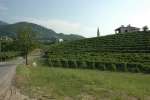
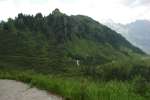
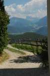
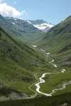
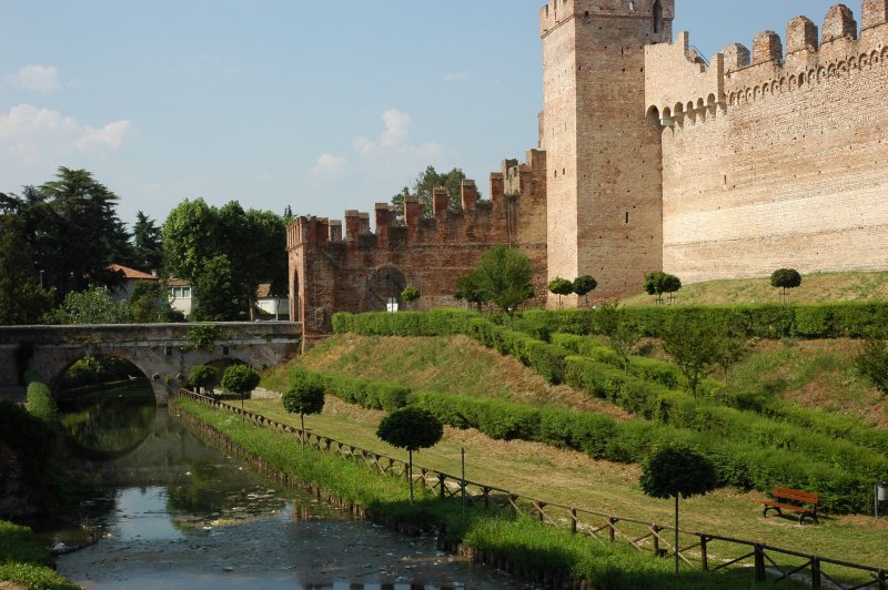
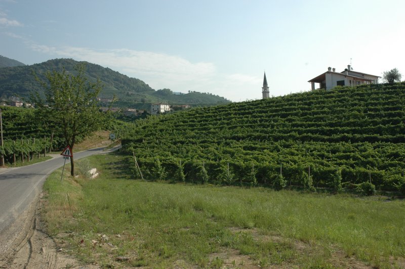
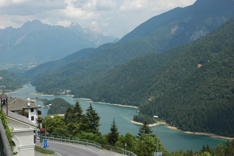
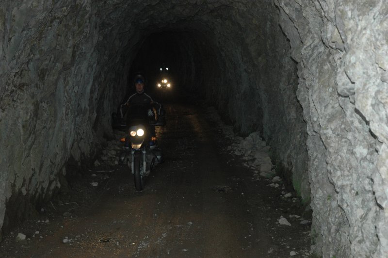
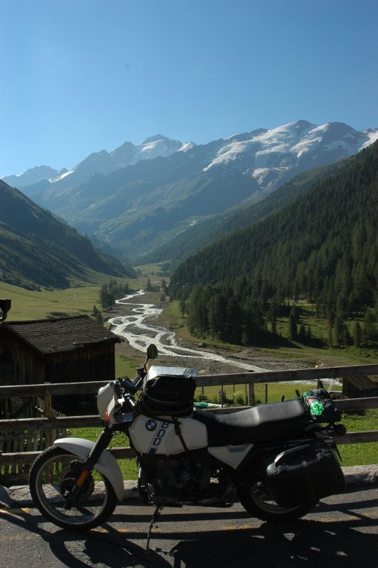
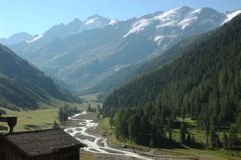
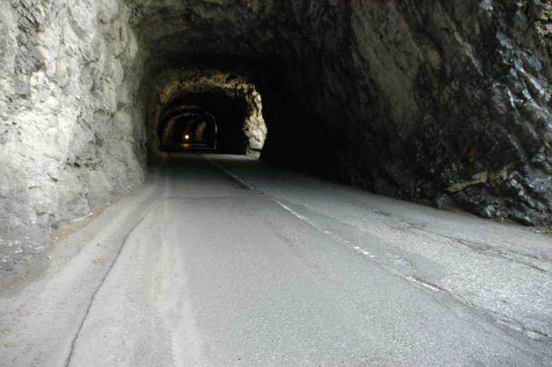
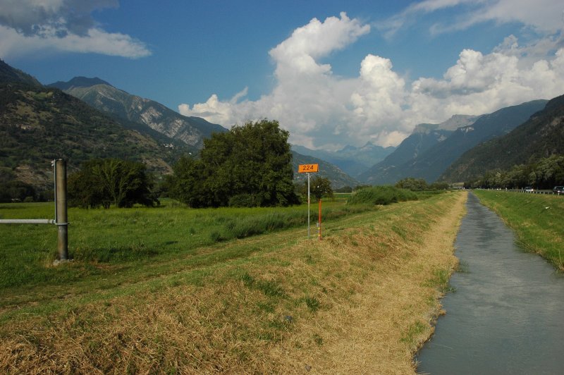
After about 60 km 
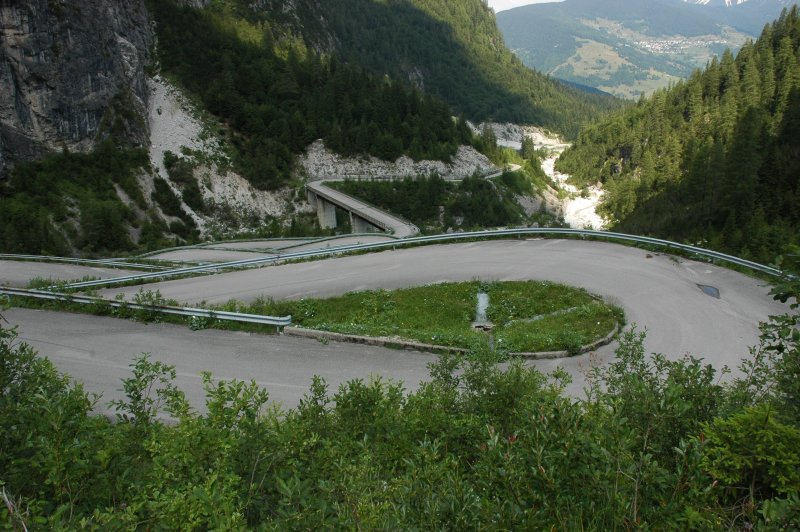
of ride, passing via Castelfranco Veneto with its castle, I reached the Passo di San Boldo. Its "only" 706 m are not spectacular to read, but the installation is definitively worth a visit. It already starts with the fact 
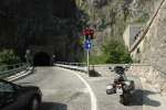
that you enter the valley from south without seeing any sign of the pass as such ... and then you're led through a series of five hairpins which are all located in tight tunnels (3.2 m wide) without any light ;-).

./20060711T070130.jpg ./20060711T084432.jpg ./20060711T090522.jpg ./20060711T091700.jpg

Enter the Dolomites

From there, my way led me via Sospirolo to the Lago di Mis and its (currently dry) channel, from there to the Forcella Franche (992 m) and across Passo Duran (1601 m). This part of the trip was actually the entrance door to the Dolomites "as we know them", since the landscape changed notably from the rather soft meadows and slowly-rising mountains to the harsh and steep rocks that form the core of Dolomites. Passo Cibiana (1531 m) was the last pass before I arrived in Pieve di Cadore.

./20060711T095212.jpg ./20060711T095642.jpg ./20060711T100353.jpg ./20060711T102446.jpg ./20060711T105011.jpg ./20060711T105110.jpg ./20060711T105117.jpg

Arrival in Pieve di Cadore

Arriving in Pieve di Cadore and at the hotel Progresso, just at about lunchtime, the owner immediately knew what he had to do with a motorcyclist ("ehm ... rider?") and led me to the backyard of the hotel where only a lonely 650GS was parked. Since all the other AdvRiders were obviously absent (as I learned a few hours later, they were climbing around the Falzarego fortress at that time), I made myself comfortable, took a shower, had a good nap to recover from the last night and then strolled through the village. Did you know that the painter Tizian was born and grew up next door to Hotel Progresso?

./20060711T114428.jpg ./20060711T114447.jpg
./20060713T074141.jpg ./20060713T231752.jpg ./20060711T133942.jpg ./20060711T134308.jpg ./20060711T134841.jpg ./20060711T134857.jpg ./20060711T144217.jpg ./20060711T144301.jpg

Hotel Progresso, Pieve di Cadore

The hotel was indeed quite a particular place: Built as a postal station somewhere in the 19th century, it was last renovated in 1958 ... and obviously preserved in that state ever since. The furniture, the rooms, the lamps, even the owner give you the feeling of being in the late 1950s. The hotel has no telefax, probably no computer either, but a manually operated switchboard and can reportedly be reached by phone ;-)

./20060711T134015.jpg ./20060711T144236.jpg ./20060711T144355.jpg ./20060714T083539.jpg ./20060714T083601.jpg ./20060714T083652.jpg ./20060711T164254.jpg ./20060714T083810.jpg

Meet the AdvRiders

Later that afternoon, a bunch of AdvRiders were showing up, slightly exhausted from their Falzarego visit. The evening was planned to be rounded off with excellent Pizzas in the next village, so most of us decided to have a walk. It was then that Bavarian, who had taken his GS, came back to us footers on the way and "kind of" laughed, saying that GiorgioXT's "10 min" indication were probably done by bicycle ... but finally GiorgioXT kindly provided a shuttle taxi service back and forth between food and the hotel.

Note to the innocent reader: Do not worry ... this seemlingly rude gesture is nothing less that The Official Adventure Rider Salute!

./20060711T205510.jpg ./20060711T211550.jpg ./20060711T211757.jpg ./20060711T211841.jpg ./20060711T212144.jpg ./20060711T213041.jpg ./20060711T214422.jpg ./20060711T214539.jpg ./20060711T214611.jpg ./20060711T215521.jpg

Late at night ...

Even the evening program was composed all by itself: Later on that night, sitting in front of the hotel and trying to decide between beer and bed, Jochen dropped by and told us that his GS' starter motor would not start the engine - and the symptoms were exactly those of a loose magnet. Since I know the Valeo starters rather well from my airheads and Possu knew how to disassemble an oilhead, we gave it a try. Indeed all four (!) magnets had come loose, but were intact. And in the meantime, just to distract the others, a few young locals passed by and invited the AdvRiders to some rope pulling :-)

./20060711T231730.jpg ./20060711T231744.jpg ./20060711T231931.jpg ./20060711T231946.jpg
./20060711T232207.jpg ./20060711T234440.jpg ./20060711T234511.jpg ./20060712T003029.jpg

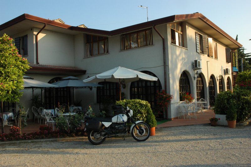
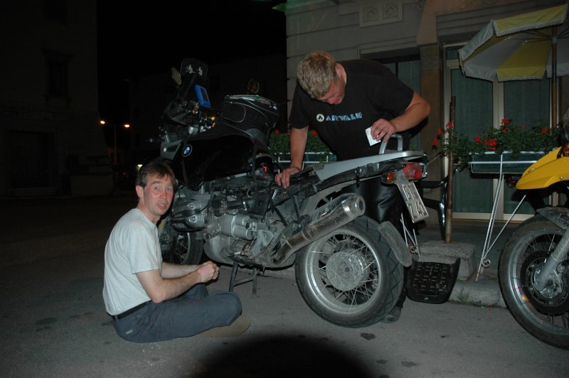
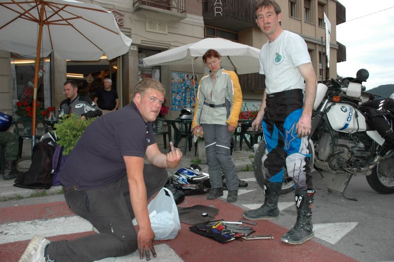
Wednesday, 2006-07-12

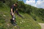
Getting up, changing the tire

I usually need to have a good breakfast to start the day. Now, my biggest problem related to this topic was that The Typical Italian Breakfast is not a breakfast at all (... at least according to my scale ;-). You get some small bread with a styrofoam-like texture, some biscuits (à la Zwieback) in plastic wrapper, some confiture and artificial honey and you are apparently supposed to start a day with that ... but well, at least the coffee was good!

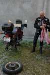
While Jochen was looking for a spare starter motor from a junkyard (swapping its magnet housing is easier than trying to glue the magnets back in), my day started with a tire change. Since my GS's rear Mitas E08 was just about used up, GiorgioXT had ordered a Mitas E07 for me and I rode with the tire to the shop he indicated. Unfortunately they were already very busy, so that the change would have had to be delayed ... but no problemo: I was simply directed to the next shop, right in front of the fire squad a Pieve di Cadore. The good surprise was not only that I could have the tire changed within the hour, but that the people in the shop were also very kind (I do not speak any Italian, but as long as you can move your hands and arms you can communicate just about everything there ;-). Together with a gulp of oil for the GS, the whole thing cost barely 10 € - !

An abandoned 'Bunker-Restaurant'

I arrived back at the hotel just at the very moment when GiorgioXT and his son Alvise were getting ready for an excursion with the group. This was actually a short trip to an abandoned fort, situated less than a km south of Tai di Cadore. The installation dates back to WWI, had been converted into a restaurant some time back but abandoned later on.

./20060712T112523.jpg ./20060712T112532.jpg ./20060712T113416.jpg ./20060712T113429.jpg ./20060712T113452.jpg ./20060712T113625.jpg ./20060712T113939.jpg

"A short ride around the Marmarole"

Following this, we went back to the hotel since a few more AdvRiders planned to join us for the following trip, once they had finished wrenching ;-). It was planned as "a short ride" around the Marmarole, so we took the short strech to Lozzo di Cadore where the road up the mountain starts. The way up is composed of a number of switchbacks on tarmac, bringing you from ~800 m to ~1800 m and then on a gravel road to Rifugio Bajon ... a site with an exceptional view! After a good lunch break (with the ubiquitous Italian starters: home-made sausages, fumed ham and cheese), we had pasta and/or a good thick soup. And, of course, the dessert. Much better than this slightly deficient breakfast :-)

./20060712T120417.jpg ./20060712T120636.jpg ./20060712T120715.jpg

./20060712T131852.jpg ./20060712T131946.jpg ./20060712T132019.jpg ./20060712T151546.jpg

Rifugio Bajon

./20060712T133402.jpg ./20060712T133453.jpg ./20060712T135352.jpg ./20060712T143757.jpg ./20060712T144816.jpg

Photo session

./20060712T153529.jpg ./20060712T153634.jpg ./20060712T153637.jpg ./20060712T153641.jpg ./20060712T153644.jpg ./20060712T153701.jpg ./20060712T153718.jpg ./20060712T154020.jpg ./20060712T153901.jpg ./20060712T153347.jpg

Yet another bunker

Continuing that ride, we took the gravel road a few km back towards the east and went along a light gravel path and a short tunnel up the other side of the saddle, to an old fort that is which is towered by another old bunker and yet another reminder of the WWI era. Obviously - due to its position - this fort provides also a very good view over the surrounding peaks and today it carries a radio antenna. Judging from the structure of the bunker and the distribution of debris, we presumed that it was probably Loz who made it collide recently after riding across it with his GS ;-)

./20060712T154737.jpg ./20060712T154753.jpg ./20060712T155619.jpg ./20060712T155659.jpg ./20060712T155708.jpg ./20060712T155812.jpg ./20060712T160256.jpg ./20060712T160317.jpg ./20060712T160557.jpg ./20060712T160621.jpg ./20060712T160653.jpg

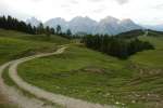
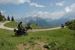
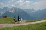
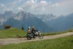
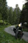
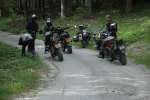
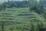
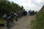
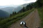
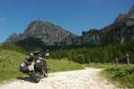
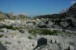
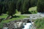
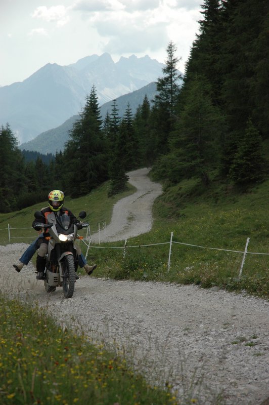
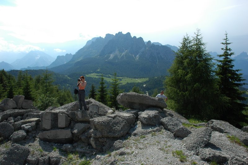
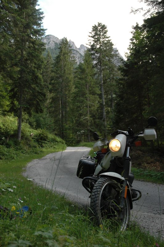
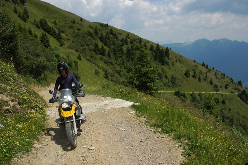
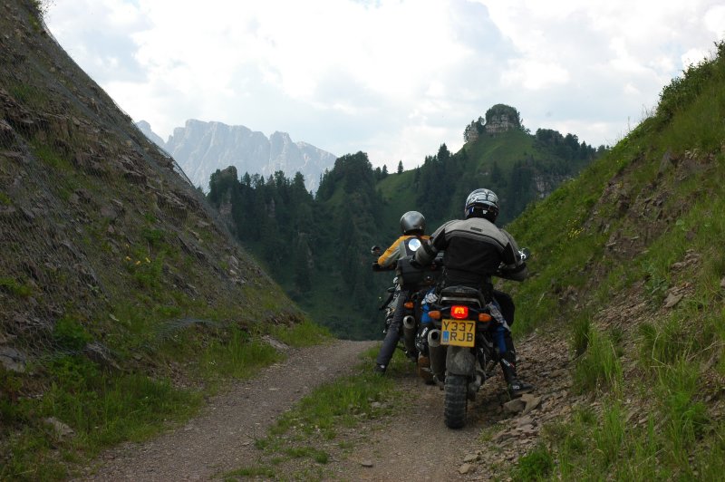
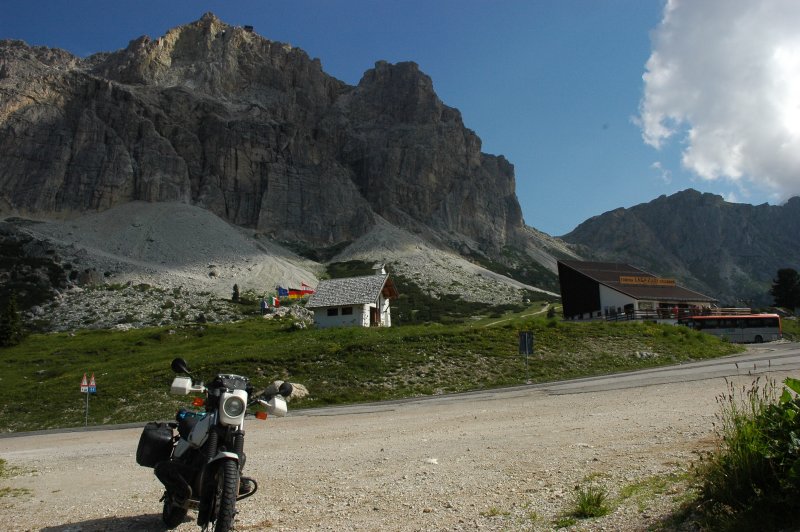
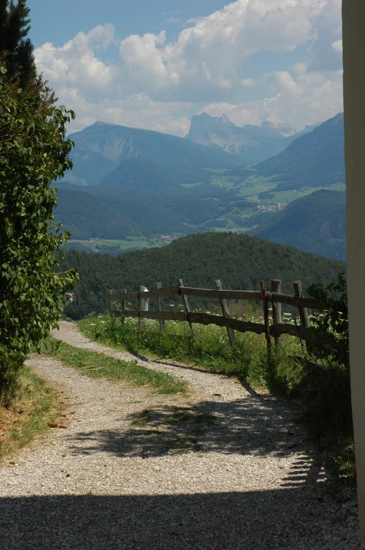
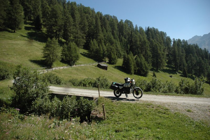
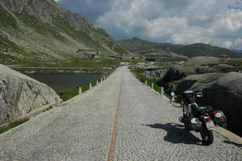
Look at that path ...

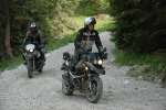
On the way back, the group split. While most went back to Pieve di Cadore (and "visited" some thermal springs on the way), a few people - namely Loz, Possu, KTiM, Vincent and myself - decided to try out
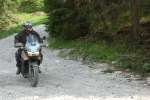
 some other path. 
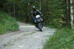
It started with a gravel path, then went on through some "slightly steeper" passages, combined with fine gravel and switchbacks. As usual, the photos do not really reflect the steepness of the area ... but we all made it safely.
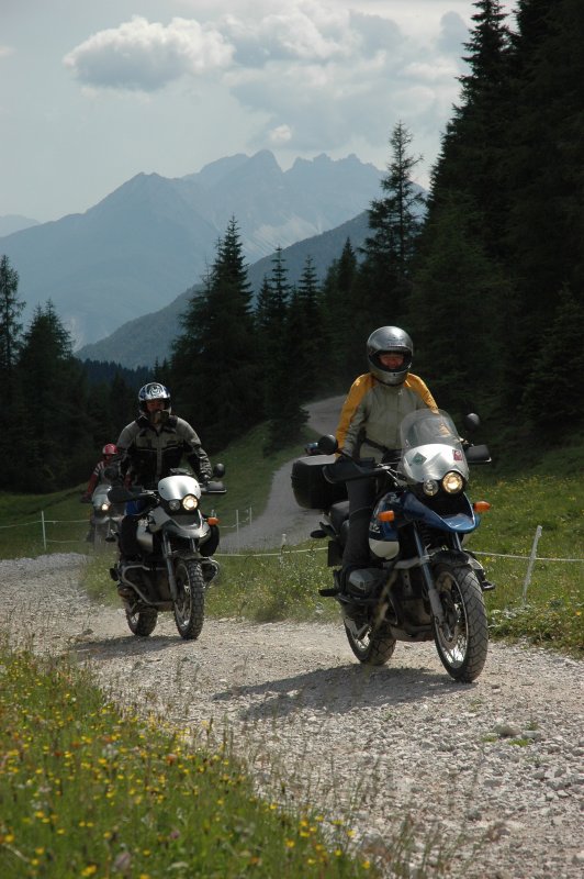
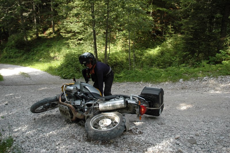
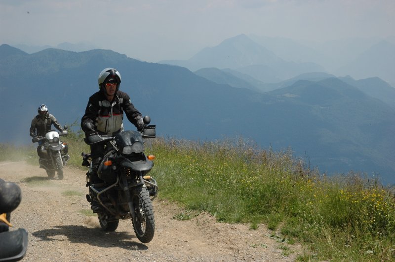
Well, almost ...

... while we were at it, all riders of that bunch except yours truly took the same path up and down again and it appears that everyone of the four dropped his bike at least one while I was having a nice calm rest in the shadows of the forest :-)

./20060712T153140.jpg ./20060712T162211.jpg ./20060712T162221.jpg ./20060712T162245.jpg ./20060712T162247.jpg ./20060712T163947.jpg ./20060712T164013.jpg ./20060712T164411.jpg ./20060712T164845.jpg ./20060712T171312.jpg ./20060712T174915.jpg ./20060712T174919.jpg ./20060712T174940.jpg

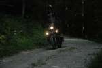
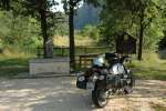
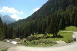
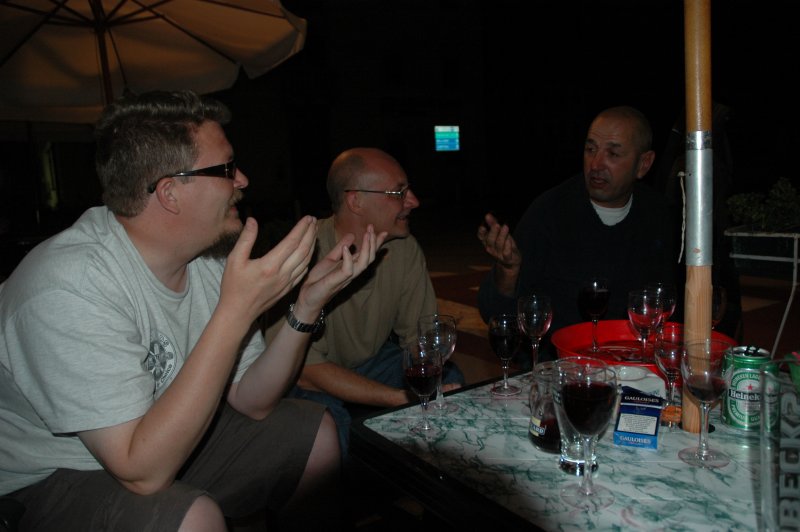
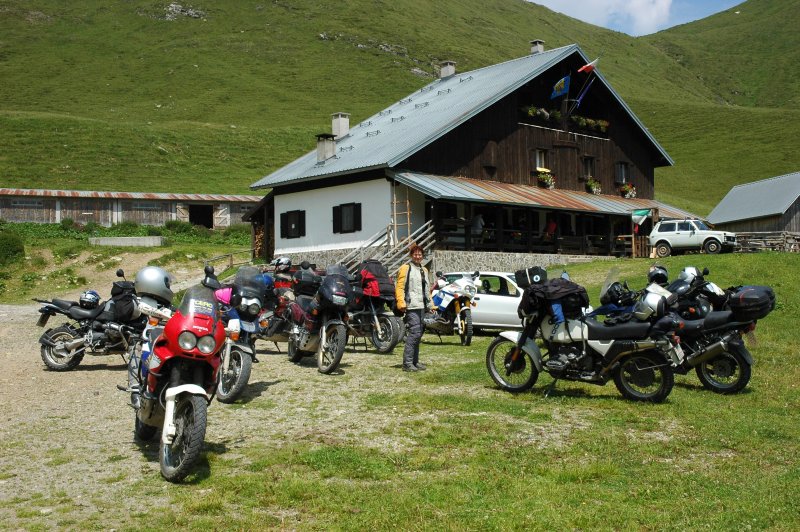
The evening saw us again in a mountain hut south-west of Pieve di Cadore , where GiorgioXT provided the "taxi service". No photos from me here, as I left my camera at the hotel.

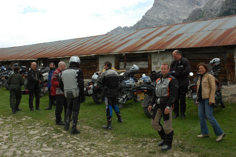
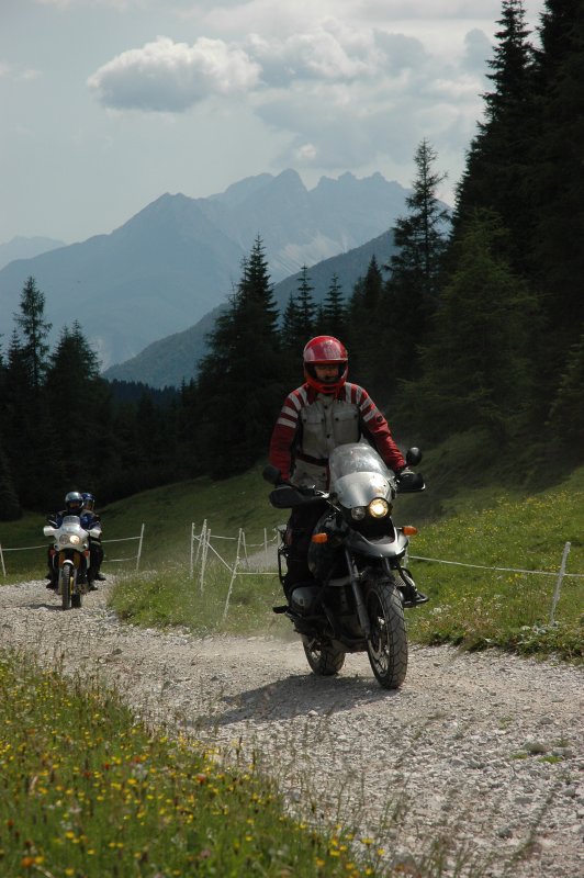
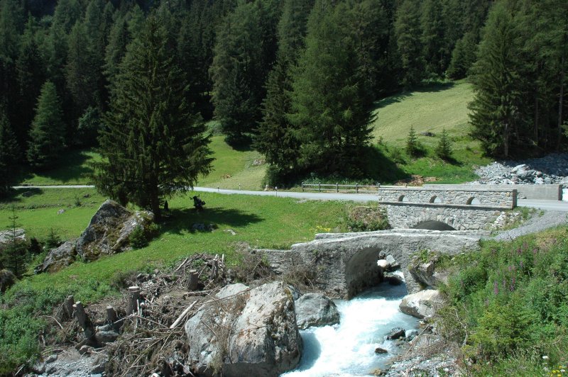
Thursday, 2006-07-13
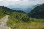
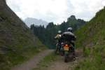
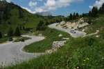
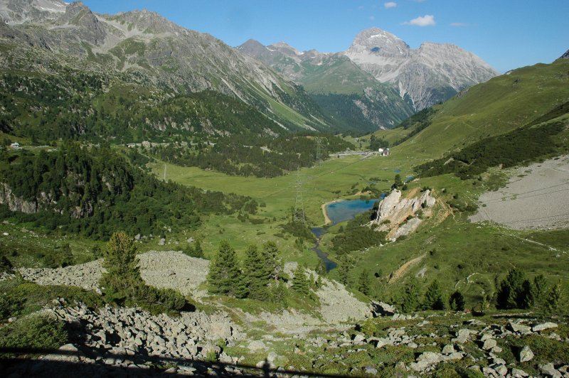
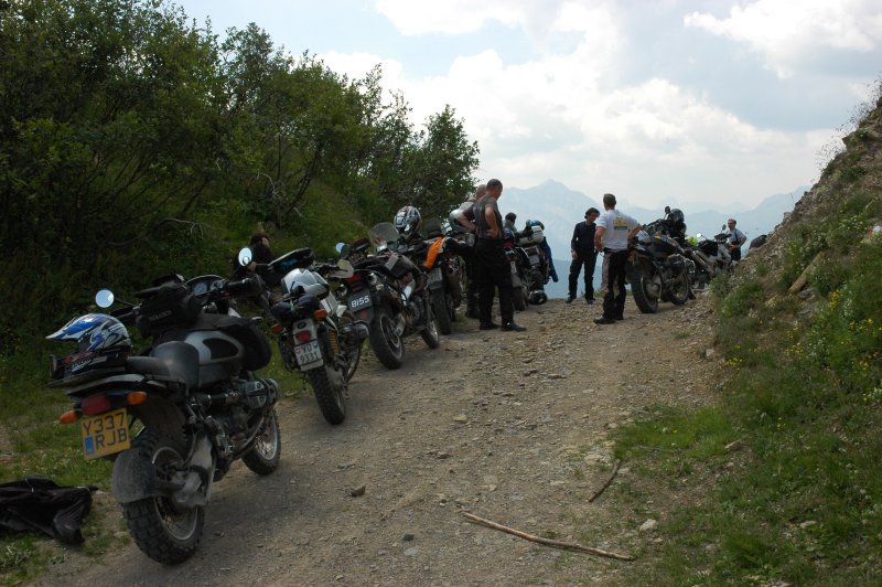
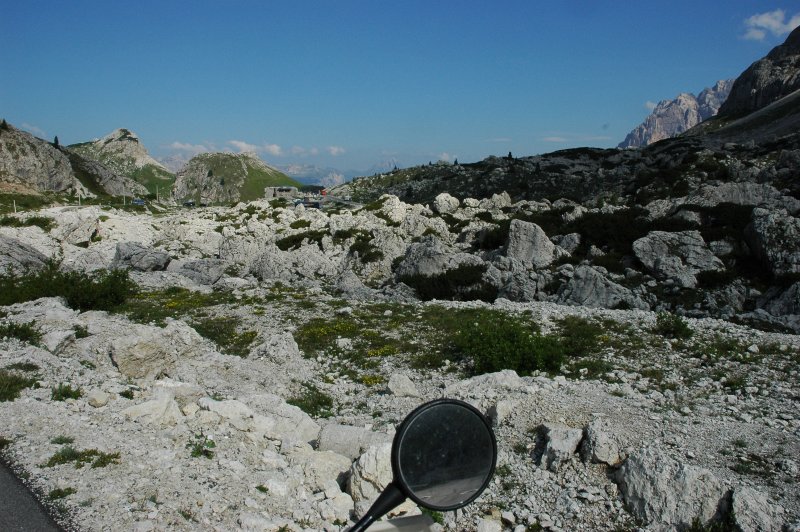
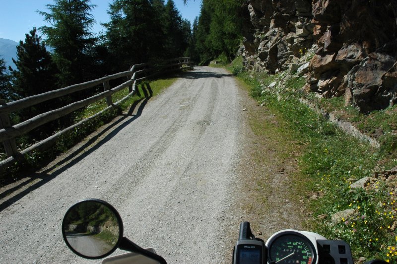
Gravel day

After the usual preparations - such as minor repairs, attempts to sell broken bikes, cleaning ducks, trying out other bikes etc - , today's ride started in a fast connecting ride via Lozzo di Cadore and Santo Stefano di Cadore to Campolongo, where we aimed south-east 
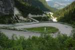
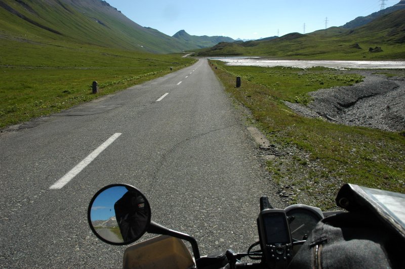
towards the SS465 leading to Forcella Lavardet (1542 m). As GiorgioXT pointed out, this is quite a surreal piece of road: two long stretches of gravel, but in the middle there is perfect tarmac, 14 switchbacks that are perfectly paved and equidistant and that can be ridden well without changing gears, just with the throttle.

At Forcella Lavardet, we took the way south to Sauris di Sopra and the Lago di Sauris and after a short break we headed for Ampezzo. Instead of taking the Passo di Pura (1425 m), we followed the SS73, then the road from Ampezzo towards the east until Villa Santina.

./20060713T093226.jpg ./20060713T102949.jpg ./20060713T104247.jpg
./20060713T111609.jpg ./20060713T111620.jpg ./20060713T111852.jpg ./20060713T120732.jpg ./20060713T123454.jpg

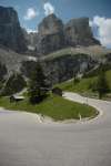
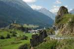
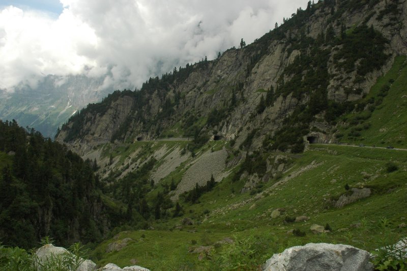
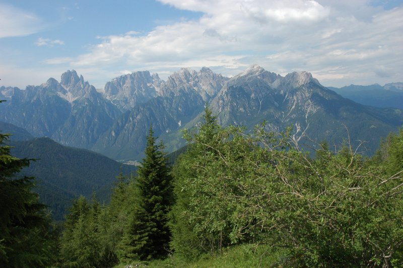
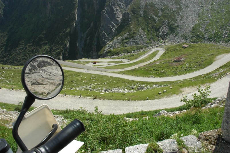
Col Gentile, not really gentle ...

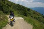
The more difficult road that GiorgioXT had mentioned started from Ovaro/Mione (710 m) and returned to Sauris Valley via the Forcella Col Gentile (1839 m). The road starts as a small side way in the village, merely recognisable by the indication panels. After a number of tight switchbacks on tarmac, it soon becomes a number of tight switchbacks on gravel, then a number of tight switchbacks on loose and coarse gravel. The challenge is not just the gravel, but the fact that the short ramps between the numerous switchbacks carry a number of water drains ... made from concrete, about 50 cm wide and some 15...20 cm deep, which means that you cannot just run across them with speed. Add to this a slope of sometimes up to 30% (overall, the road climbs from ~550 m to 1800+ m within ~9 km) and you will understand why I ran almost the whole path in first gear.

All of us made it without major problems, just one dropped bike. But lots of sweat and adrenaline!

By the way, Denzel describes this road with "SG 4-5" in the 22nd edition of his Alpenstrassenführer ... from west to east, that is. We just did it the other way round.

./20060713T133518.jpg ./20060713T133145.jpg ./20060713T134142.jpg ./20060713T134424.jpg ./20060713T134545.jpg ./20060713T134811.jpg ./20060713T134324.jpg ./20060713T135707.jpg

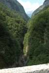
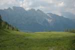
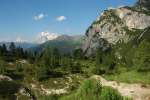
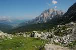
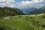
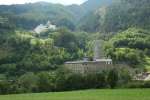
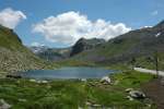
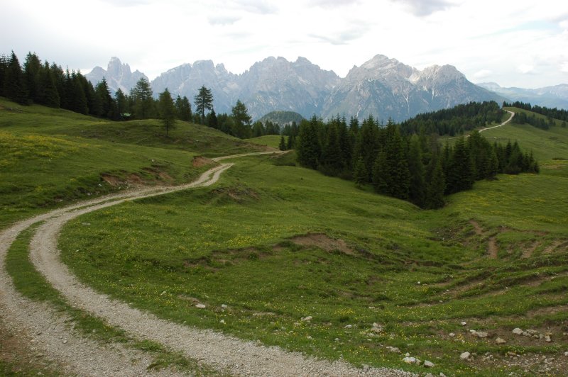
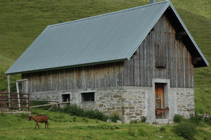
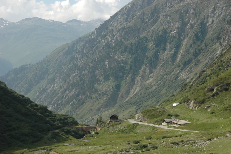
Rifugio Lôsa, a place close to paradise

Soon afterwards, we arrived at Rifugio Lôsa, which is quite a paradise. If you really want to be in the middle of nowhere, this is one of the the places to reach for:

./20060713T140712.jpg ./20060713T141710.jpg ./20060713T145415.jpg ./20060713T150539.jpg ./20060713T150923.jpg

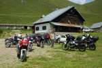
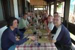
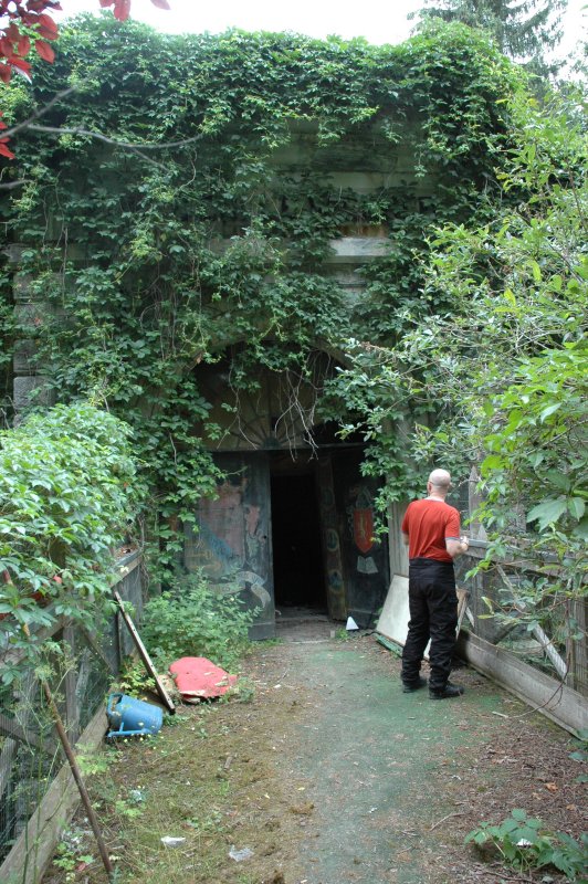
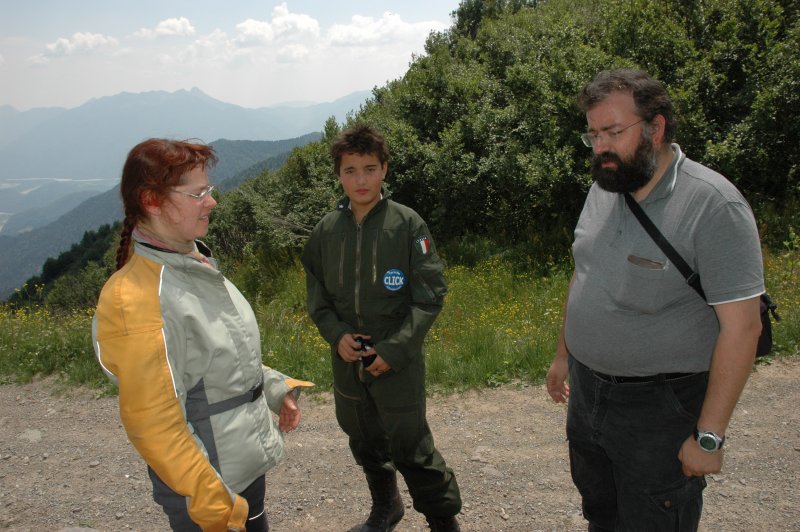
After the well-merited lunch and some strange encounters, the crowd took a gravel highway to the west for about 3...4 km until we reached another rifugio. Instead of backing out to the southwest, the 1:50k map showed another path towards the north.

A path that was even new to GiorgioXT.

Of course we had to try this out.

The path was covered with harsh gravel, interdispersed with concrete plates in the steepest places and led over another little pass whose name I forgot. After a short but steep descent, we arrived at another - at that time empty - rifugio and had a short break to 
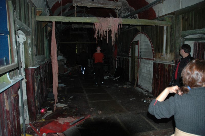
admire the landscape. The path then descended further towards the north on a steep path with a number of switchbacks, but this did not stop two huge trucks of the 20+ ton category going up that same path. I wonder how much time that would take? - The road then met the tarmac just west of Sappada in the Val Pesarina.

./20060713T153448.jpg ./20060713T154121.jpg ./20060713T154233.jpg ./20060713T154713.jpg ./20060713T154744.jpg

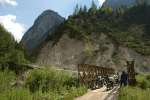
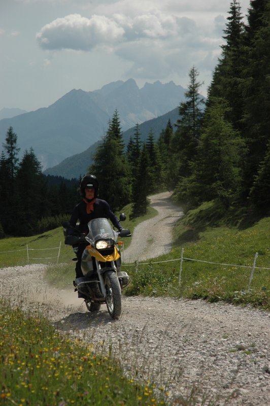
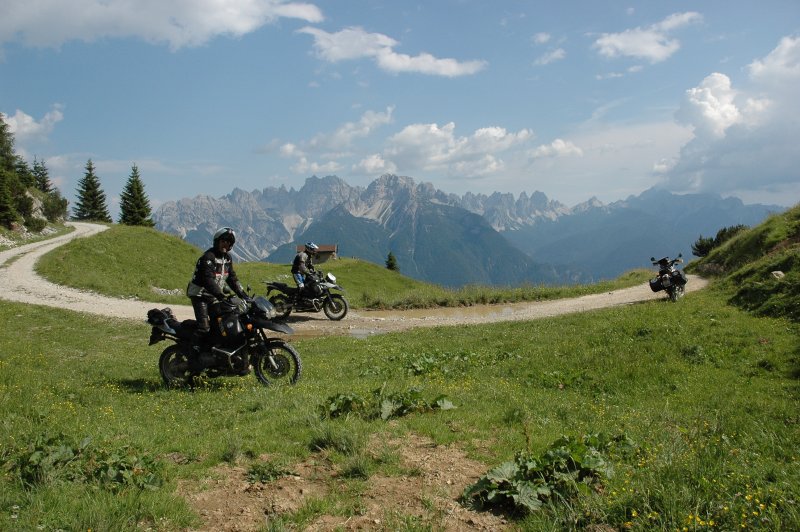
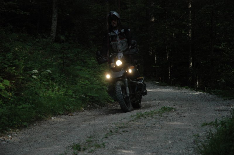
Enough dust for today

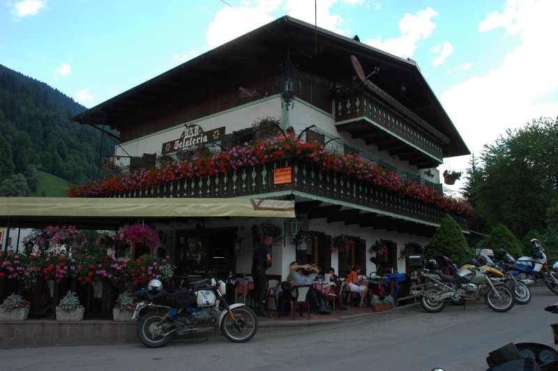
From there, we danced through the curves on the way west, enjoyed the Forcella Lavardet again, took first some ice cream and then another shortcut through the forest near 
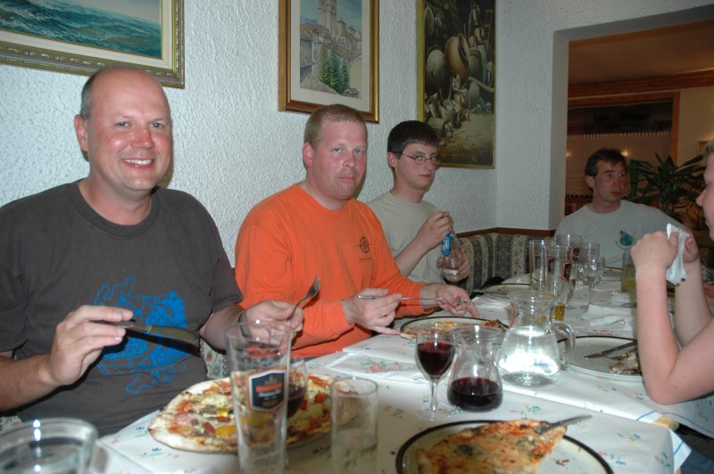
Vigo di Cadore and had a huge thunderstrom and shower on the way back to the hotel. In the evening, pizza again :-)

./20060713T164547.jpg ./20060713T172138.jpg

Friday, 2006-07-14

Time to leave.

After the usual pseudo-breakfast, I prepared my luggage, said Goodbye to all the AdvRiders that were awaken, took a last look around, and hit the road. 
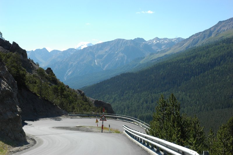
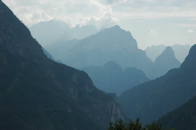
Passing via Cortina d'Ampezzo, I rode up the Falzarego pass (2105 m). After a short short sidestep towards Passo di Valparola (2192 m, "while we're at it"), I suffered the "ride or watch" problem again ... that region is just too beautiful to pass through ;-)

The whole region is a place where many soldiers left their lives in WWI. Not only the memorials, museums and installations around the Falzarego show this, but also the graves: On the way to Passo di Fedaia (2057 m), the view down to Rocca Pietore reveals a cross-shaped cemetery.

./20060714T083923.jpg ./20060714T093212.jpg ./20060714T094513.jpg ./20060714T095224.jpg ./20060714T095228.jpg ./20060714T095246.jpg ./20060714T095522.jpg ./20060714T095742.jpg ./20060714T101508.jpg ./20060714T101511.jpg

Not exactly as it was planned ...

Looping back across Passo Pordoi (2239 m) and Passo di Campolongo (1875 m), I finally headed west over Passo di Gardena (Grödnerjoch, 2121 m; this is where rallybug crashed on the same day).

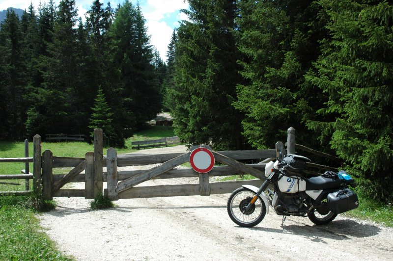
My original plan was then to cut across from Monte Pana via San Valentino to the west, but a white/red sign together with a closed gate signalled that this would not quite go as I planned it. Thus, I had to stay on the main road, which made a rapid but straight descent towards Ponte Gardena.

./20060714T104031.jpg ./20060714T104324.jpg ./20060714T111242.jpg ./20060714T111332.jpg ./20060714T111703.jpg ./20060714T114156.jpg ./20060714T115430.jpg ./20060714T115833.jpg ./20060714T120218.jpg ./20060714T122126.jpg ./20060714T123104.jpg

The next step in my planning was to ride from Ponte Gardena to Valle Sarentina, then north and include the Penserjoch and Jaufenpass, but I had to abandon this, too ... huge black clouds gathered right there, so I changed plans again and headed from Ponte Gardena to Barbiano, then over Lengmoos and other little places to Bozen.

./20060714T125937.jpg ./20060714T132146.jpg

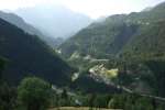
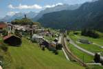
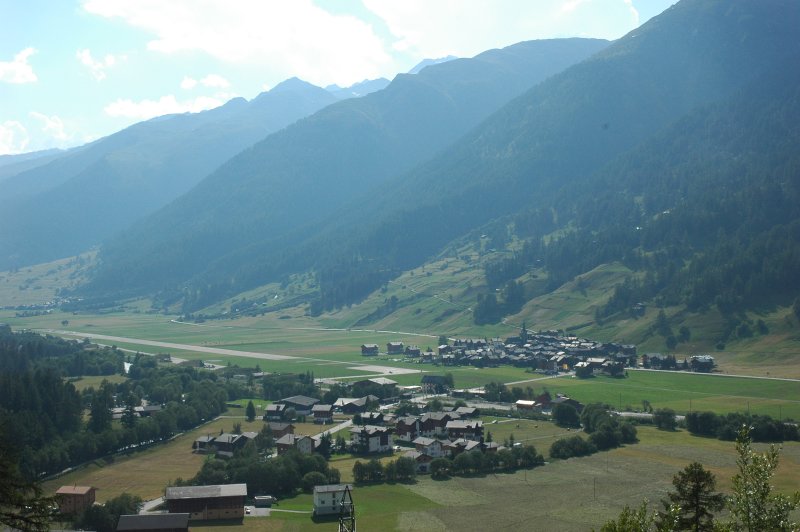
From Bozen to Reschen

Bozen as such may be a nice city, but I had problems finding the right way out of it towards Merano. While I was looking for secondary roads, the road signs all led to the highway - and astonishingly twice, once in green and once in blue. I finally found out that the "blue one" was a tax-free highway, so I took this way until Lana. 
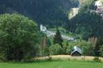
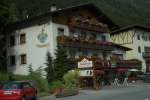
After gassing up in Merano, I noticed that I was getting tired from the heat, so I looked up my hotel guide and found a suitable place just a few kilometers further, in Reschen. The hotel is pretty well known among motorcyclists and when I was back after a stroll around the place I met two DS riders from Austria (KTM 640 and Africa Twin) and we had a really nice evening in the local Pizzeria.

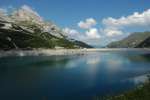
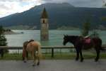
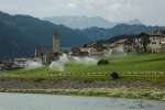
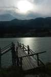
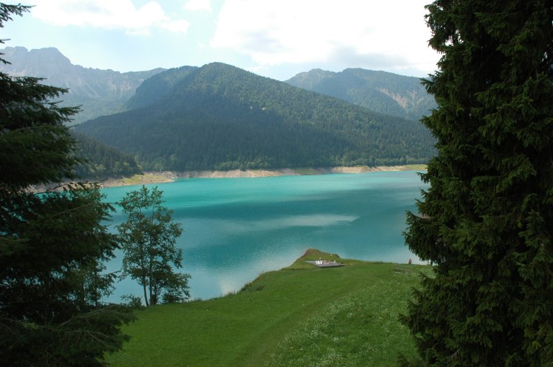
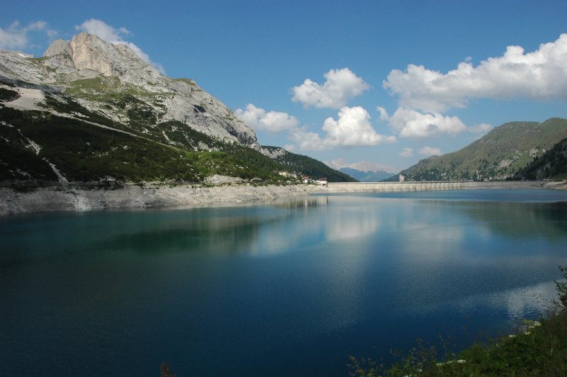
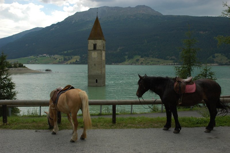
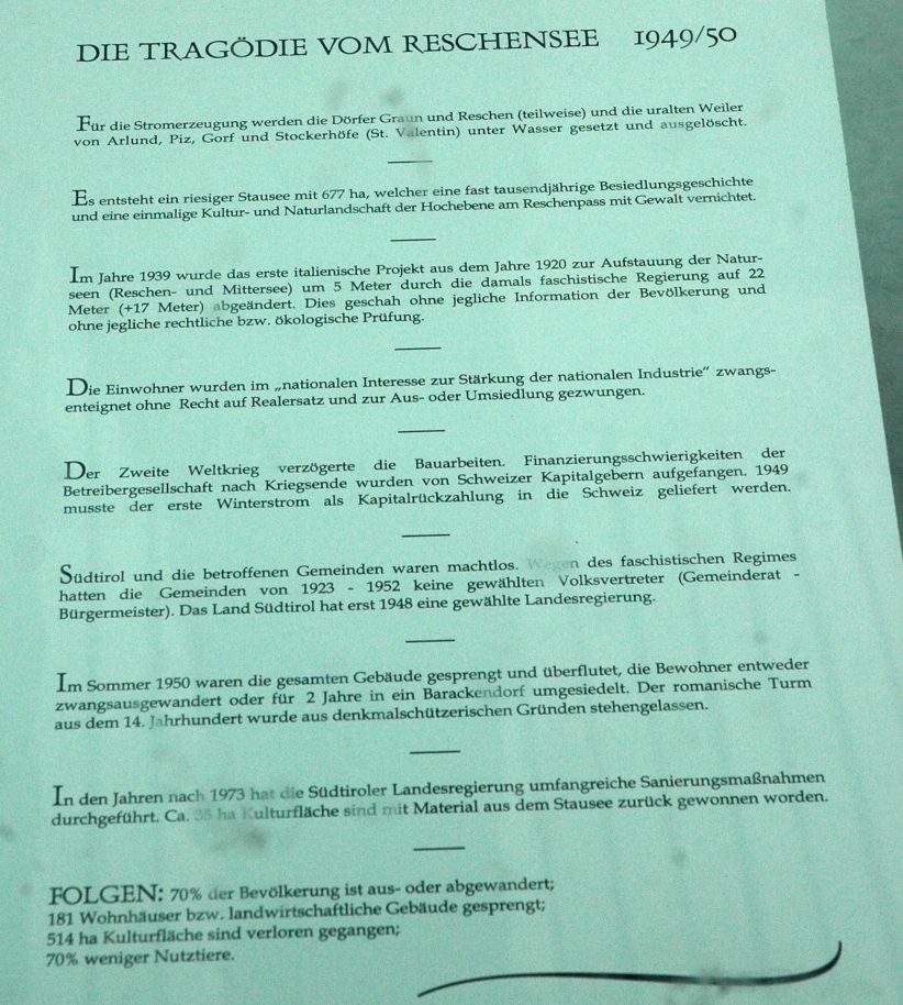
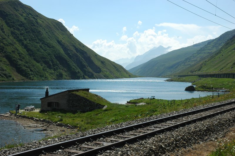
The Lago di Reschen or Reschensee is actually a rather recent, artificial lake, dating from the 1950s. It was created against the will of many of the population, flooding a unique natural area and a number of villages at the same time. As the only building, the bell tower of Alt-Graun is still standing, sticking out of the water like a reminder; all the other buildings were destroyed with explosives. A memorial nearby explains the history of the lake.

./20060714T161950.jpg ./20060714T162419.jpg ./20060714T163816.jpg ./20060714T163840.jpg ./20060714T163957.jpg ./20060714T182555.jpg ./20060714T182934.jpg ./20060714T183007.jpg ./20060714T184429.jpg

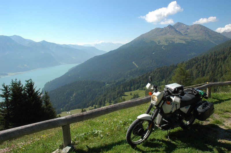
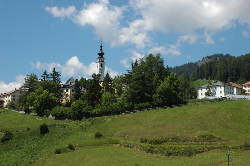
Saturday, 2006-07-15

Around Reschen

Yesterday evening's conversation and a quick glance in the Denzel had shown that I had come to the right place: A number of minuscule roads leads into the mountains around Reschen. After a good, rich, healthy breakfast (!), I started the day with a visit to the Valle Lunga, located at the eastern side of the Reschensee. Following this beautiful breeze of mountain air, I rode over to the minuscule village of Rojen (1968 m) on the other side of the lake with its old church (14th century; unfortunately the door was locked) and finally the light gravel highway up to the Reschenalm (2001 m), offering a splendid view over the Reschensee.

./20060715T091531.jpg ./20060715T092328.jpg ./20060715T092339.jpg ./20060715T094039.jpg ./20060715T100236.jpg ./20060715T100341.jpg ./20060715T101604.jpg ./20060715T102113.jpg ./20060715T102435.jpg

Short excursion to Samnaun

Coming down from the Reschenalm, I finally went via Reschenpass (1507 m) and the phantastic Norberthöhe down to Martina, which is the eastern entry door to Switzerland. Nevertheless, before definitively entering Switzerland I took a detour to Samnaun. The place itself is a Swiss tax exclusion zone, which means that most of the visitors do not come for the landscape but for shopping ;-) For a motorcyclist, the road leading to that place and the landscape are probably more interesting than the village itself; a more recent road was constructed at the northern side of the valley, but I took the same way back that I came. It is a narrow, rough road with lots of tunnels, where only one car can pass at a time. Indeed a KTM rider had crashed on its way up, but when I came to the site of the accident it was already cleaned up and apparently the rider was not injured. Pffft.

./20060715T110259.jpg ./20060715T110302.jpg ./20060715T111647.jpg ./20060715T114952.jpg ./20060715T115553.jpg

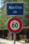
Re-entering Switzerland

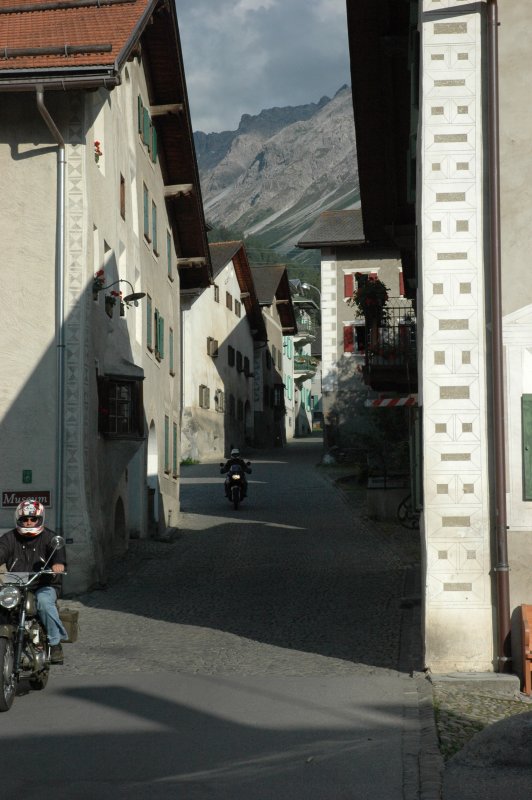
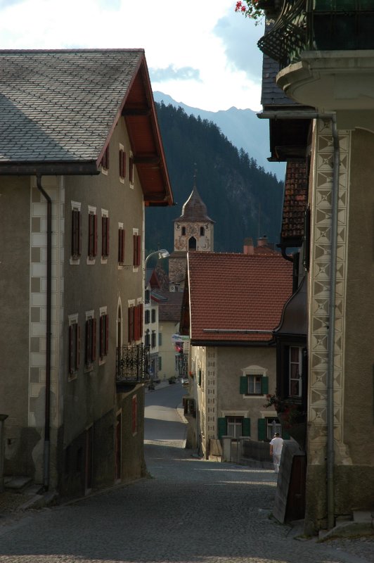
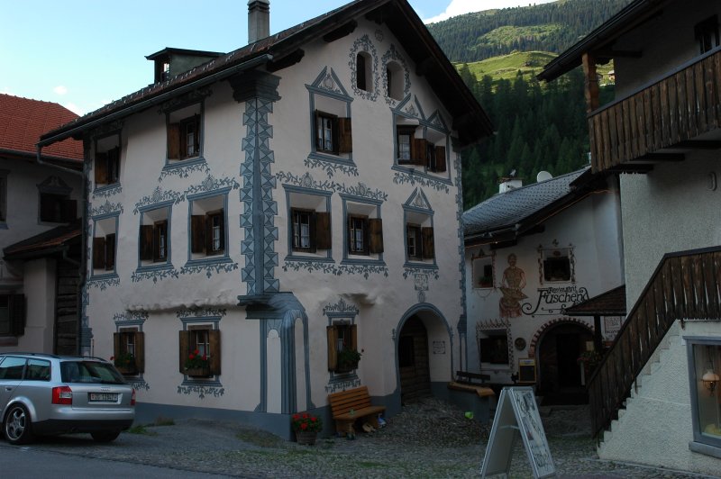
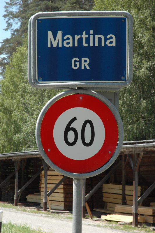
Coming back to Martina, I finally entered Switzerland again, right in the heart of the Engadin. I still stayed away from the primary roads and passed through pittoresque villages with names like like Sent, Ftan, Bos-cha and Guarda. The main "problem" was again the landscape: you have to decide between watching, taking pictures and riding! And if some friend of miniature trains is lacking inspiration, well, then I just recommend a trip to this place ...

./20060715T115927.jpg ./20060715T122559.jpg ./20060715T123208.jpg ./20060715T124215.jpg ./20060715T124256.jpg ./20060715T125643.jpg ./20060715T130107.jpg

The reminder of the day was spent on faster roads. Susch, Flüelapass (2383 m), down to Davos with its jet-set. Tiefencastel and Thusis again, then briefly back on minor roads via Bonaduz and Obersaxen, Disentis and over the Oberalppass (2044 m).

./20060715T131823.jpg ./20060715T132758.jpg ./20060715T133400.jpg ./20060715T145334.jpg ./20060715T161036.jpg

Enter Valais

Arriving in Andermatt, I decided to pass through the Valais, which means that I took the old St-Gotthard route (2108 m) with its numerous switchbacks on the cobblestone road. I really recommend this part to every motorcyclist, since it not only bypasses the (rather boring) new Gotthard road but also presents a wonderful impression of the engineering at that time.

./20060715T163314.jpg ./20060715T163648.jpg ./20060715T163744.jpg ./20060715T163945.jpg

The Gotthard route ends in Airolo and the Nufenen pass (2478 m) ending in Ullrichen rounded off my number of alpine passes for this time.

./20060715T171526.jpg ./20060715T171741.jpg ./20060715T173317.jpg ./20060715T174000.jpg ./20060715T174426.jpg

The quick way home - after crossing Switzerland from east to west

The remaining road led through the beautiful valleys of the eastern Valais until Sierre, where I finallly took the highway for the last ~120 km of this trip.

I arrived home after a 610-km trip where I spent almost 12 hours in the saddle. Essentially this last day meant crossing almost the whole of Switzerland from east to west in one day ... !

./20060715T175001.jpg ./20060715T175007.jpg ./20060715T184825.jpg ./20060715T185954.jpg ./20060715T200017.jpg ./20060715T203451.jpg

Slideshow

Links to more pictures